
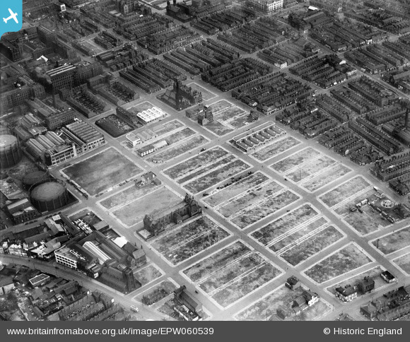
EPW060539 ENGLAND (1939). Slum clearance around George Street and environs, Manchester, 1939
© Hawlfraint cyfranwyr OpenStreetMap a thrwyddedwyd gan yr OpenStreetMap Foundation. 2026. Trwyddedir y gartograffeg fel CC BY-SA.
Delweddau cyfagos (5)
EPW060539

EPW017524

EPW055076

EPW062710

EPW062699

Manylion
| Pennawd | [EPW060539] Slum clearance around George Street and environs, Manchester, 1939 |
| Cyfeirnod | EPW060539 |
| Dyddiad | 14-February-1939 |
| Dolen | |
| Enw lle | MANCHESTER |
| Plwyf | |
| Ardal | |
| Gwlad | ENGLAND |
| Dwyreiniad / Gogleddiad | 383716, 397118 |
| Hydred / Lledred | -2.2453428960242, 53.4702924299 |
| Cyfeirnod Grid Cenedlaethol | SJ837971 |
Pinnau

Sloopy |
Tuesday 8th of March 2022 11:50:07 AM |