
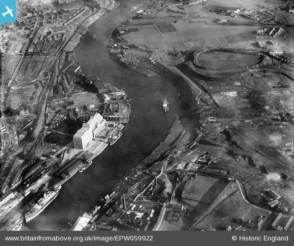
EPW059922 ENGLAND (1938). The Tyne Flour Mill, the River Tyne and the Quayside, Newcastle Upon Tyne, 1938. This image has been produced from a damaged negative.
© Hawlfraint cyfranwyr OpenStreetMap a thrwyddedwyd gan yr OpenStreetMap Foundation. 2026. Trwyddedir y gartograffeg fel CC BY-SA.
Delweddau cyfagos (7)
EPW059922

EPW059923

EPW062212

EPW062213

EPW059920

EPW059921

EPW059919

Manylion
| Pennawd | [EPW059922] The Tyne Flour Mill, the River Tyne and the Quayside, Newcastle Upon Tyne, 1938. This image has been produced from a damaged negative. |
| Cyfeirnod | EPW059922 |
| Dyddiad | 11-October-1938 |
| Dolen | |
| Enw lle | NEWCASTLE UPON TYNE |
| Plwyf | |
| Ardal | |
| Gwlad | ENGLAND |
| Dwyreiniad / Gogleddiad | 426993, 563477 |
| Hydred / Lledred | -1.578350576145, 54.965112047012 |
| Cyfeirnod Grid Cenedlaethol | NZ270635 |
Pinnau
Byddwch y cyntaf i ychwanegu sylw at y ddelwedd hon!