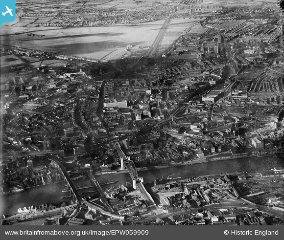
EPW059909 ENGLAND (1938). A cityscape from Tyne Bridge to the Town Moor, Newcastle Upon Tyne, 1938
© Hawlfraint cyfranwyr OpenStreetMap a thrwyddedwyd gan yr OpenStreetMap Foundation. 2026. Trwyddedir y gartograffeg fel CC BY-SA.
Delweddau cyfagos (8)
Manylion
| Pennawd | [EPW059909] A cityscape from Tyne Bridge to the Town Moor, Newcastle Upon Tyne, 1938 |
| Cyfeirnod | EPW059909 |
| Dyddiad | 11-October-1938 |
| Dolen | |
| Enw lle | NEWCASTLE UPON TYNE |
| Plwyf | |
| Ardal | |
| Gwlad | ENGLAND |
| Dwyreiniad / Gogleddiad | 425195, 564308 |
| Hydred / Lledred | -1.6063627966051, 54.972674414606 |
| Cyfeirnod Grid Cenedlaethol | NZ252643 |
Pinnau

Caroline |
Friday 16th of May 2014 10:49:21 AM | |

Caroline |
Friday 16th of May 2014 10:45:31 AM | |

Class31 |
Monday 7th of April 2014 05:41:38 PM |
Cyfraniadau Grŵp

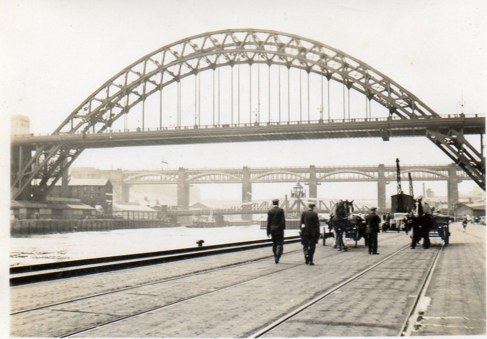
The Tyne Bridge photographed in June or July 1939 by a relative as part of a holiday album. |

Class31 |
Wednesday 20th of August 2014 10:09:31 AM |


![[EPW059909] A cityscape from Tyne Bridge to the Town Moor, Newcastle Upon Tyne, 1938](http://britainfromabove.org.uk/sites/all/libraries/aerofilms-images/public/100x100/EPW/059/EPW059909.jpg)
![[EPW059906] A cityscape from Pilgrim Street to Northumberland Street, Newcastle Upon Tyne, 1938](http://britainfromabove.org.uk/sites/all/libraries/aerofilms-images/public/100x100/EPW/059/EPW059906.jpg)
![[EPW059911] A cityscape from Pilgrim Street to the Town Moor, Newcastle Upon Tyne, 1938. This image has been produced from a damaged negative.](http://britainfromabove.org.uk/sites/all/libraries/aerofilms-images/public/100x100/EPW/059/EPW059911.jpg)
![[EPW059910] A cityscape from Pilgrim Street to the Town Moor, Newcastle Upon Tyne, 1938](http://britainfromabove.org.uk/sites/all/libraries/aerofilms-images/public/100x100/EPW/059/EPW059910.jpg)
![[EPW059908] A cityscape from Pilgrim Street to the Town Moor, Newcastle Upon Tyne, 1938](http://britainfromabove.org.uk/sites/all/libraries/aerofilms-images/public/100x100/EPW/059/EPW059908.jpg)
![[EPW059905] A cityscape from Tyne Bridge to the Town Moor, Newcastle Upon Tyne, 1938](http://britainfromabove.org.uk/sites/all/libraries/aerofilms-images/public/100x100/EPW/059/EPW059905.jpg)
![[EPW059907] A cityscape from Tyne Bridge to the Town Moor, Newcastle Upon Tyne, 1938](http://britainfromabove.org.uk/sites/all/libraries/aerofilms-images/public/100x100/EPW/059/EPW059907.jpg)
![[EPW010390] The junction of Northumberland Street and New Bridge Street, Newcastle upon Tyne, 1924. This image has been produced from a print.](http://britainfromabove.org.uk/sites/all/libraries/aerofilms-images/public/100x100/EPW/010/EPW010390.jpg)
