
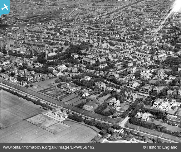
EPW058492 ENGLAND (1938). Rotten Row and the town, Southport, from the west, 1938
© Hawlfraint cyfranwyr OpenStreetMap a thrwyddedwyd gan yr OpenStreetMap Foundation. 2026. Trwyddedir y gartograffeg fel CC BY-SA.
Delweddau cyfagos (10)
EPW058492

EAW010143

EAW010145

EAW010141

EPW016820

EAW010146

EPW058489

EPW016824

EAW010140

EAW010139

Manylion
| Pennawd | [EPW058492] Rotten Row and the town, Southport, from the west, 1938 |
| Cyfeirnod | EPW058492 |
| Dyddiad | 26-July-1938 |
| Dolen | |
| Enw lle | SOUTHPORT |
| Plwyf | |
| Ardal | |
| Gwlad | ENGLAND |
| Dwyreiniad / Gogleddiad | 332843, 416713 |
| Hydred / Lledred | -3.0159499179776, 53.642380531787 |
| Cyfeirnod Grid Cenedlaethol | SD328167 |
Pinnau

NVUBU |
Saturday 23rd of May 2026 05:16:28 PM | |
|
joe |
Saturday 6th of September 2025 02:22:25 PM | |
|
Mark Farrar |
Sunday 7th of August 2016 07:11:19 AM | |
|
Chris Willis |
Thursday 25th of February 2016 05:04:44 PM | |
|
Chris Willis |
Thursday 25th of February 2016 04:59:05 PM | |
|
Chris Willis |
Thursday 25th of February 2016 04:53:01 PM | |
|
wadey |
Saturday 6th of December 2014 10:27:22 PM | |
|
wadey |
Saturday 6th of December 2014 10:26:16 PM | |
|
wadey |
Saturday 6th of December 2014 10:23:47 PM | |
|
wadey |
Saturday 6th of December 2014 10:23:13 PM | |
|
wadey |
Saturday 6th of December 2014 10:22:13 PM | |
|
wadey |
Saturday 6th of December 2014 10:21:21 PM | |
|
wadey |
Saturday 6th of December 2014 10:13:04 PM |