
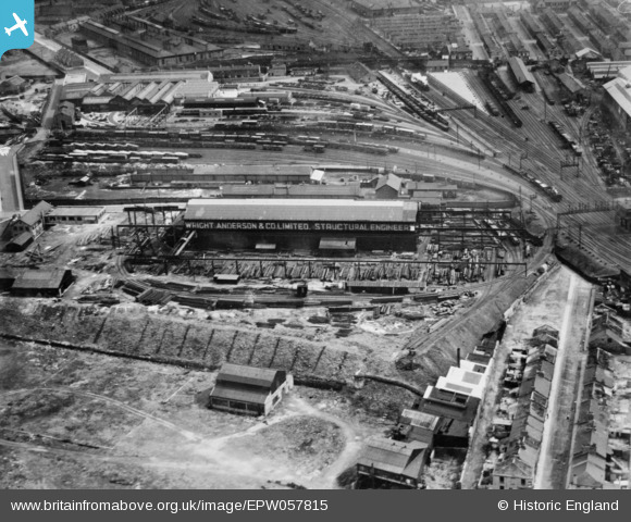
EPW057815 ENGLAND (1938). The Wright, Anderson and Co Ltd Structural Engineering Works alongside the London and North Eastern Railway Works, Gateshead, 1938. This image has been produced from a copy-negative.
© Hawlfraint cyfranwyr OpenStreetMap a thrwyddedwyd gan yr OpenStreetMap Foundation. 2026. Trwyddedir y gartograffeg fel CC BY-SA.
Delweddau cyfagos (16)
EPW057815

EAW003255

EAW003251

EAW003260

EAW003262

EAW003257

EAW003263

EAW003259

EAW003254

EAW003258

EAW003261

EAW003250

EAW003252

EAW003253

EAW003256

EPW048231

Manylion
| Pennawd | [EPW057815] The Wright, Anderson and Co Ltd Structural Engineering Works alongside the London and North Eastern Railway Works, Gateshead, 1938. This image has been produced from a copy-negative. |
| Cyfeirnod | EPW057815 |
| Dyddiad | 24-June-1938 |
| Dolen | |
| Enw lle | GATESHEAD |
| Plwyf | |
| Ardal | |
| Gwlad | ENGLAND |
| Dwyreiniad / Gogleddiad | 425967, 563557 |
| Hydred / Lledred | -1.5943697091215, 54.96588551691 |
| Cyfeirnod Grid Cenedlaethol | NZ260636 |
