
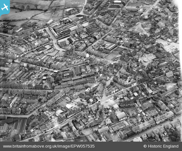
EPW057535 ENGLAND (1938). The town around the Anvil Works, Lye, 1938
© Hawlfraint cyfranwyr OpenStreetMap a thrwyddedwyd gan yr OpenStreetMap Foundation. 2026. Trwyddedir y gartograffeg fel CC BY-SA.
Delweddau cyfagos (3)
EPW057535

EPW057534

EPW035954

Manylion
| Pennawd | [EPW057535] The town around the Anvil Works, Lye, 1938 |
| Cyfeirnod | EPW057535 |
| Dyddiad | 9-June-1938 |
| Dolen | |
| Enw lle | LYE |
| Plwyf | |
| Ardal | |
| Gwlad | ENGLAND |
| Dwyreiniad / Gogleddiad | 392704, 284301 |
| Hydred / Lledred | -2.1073827046555, 52.456239838229 |
| Cyfeirnod Grid Cenedlaethol | SO927843 |
Pinnau

KtSnky |
Wednesday 8th of August 2018 03:40:46 PM | |
|
mark |
Tuesday 28th of November 2017 10:15:46 PM | |
|
mark |
Tuesday 28th of November 2017 10:13:01 PM | |
|
mark |
Tuesday 28th of November 2017 10:11:34 PM | |
|
reg instone |
Saturday 21st of February 2015 03:02:13 AM | |
|
reg instone |
Saturday 21st of February 2015 03:01:44 AM | |
|
reg instone |
Saturday 21st of February 2015 03:00:09 AM | |
|
reg instone |
Saturday 21st of February 2015 02:59:36 AM |
Cyfraniadau Grŵp
looking almost due south |
reg instone |
Saturday 21st of February 2015 03:00:39 AM |