
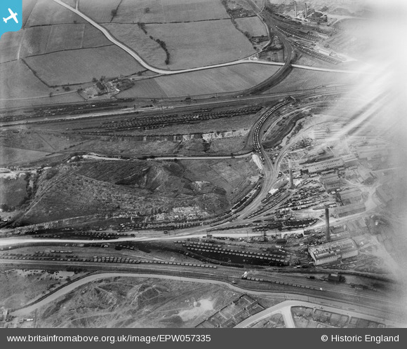
EPW057335 ENGLAND (1938). The Staveley Coal and Iron Company Ltd Works, Staveley, 1938. This image has been affected by flare.
© Hawlfraint cyfranwyr OpenStreetMap a thrwyddedwyd gan yr OpenStreetMap Foundation. 2026. Trwyddedir y gartograffeg fel CC BY-SA.
Delweddau cyfagos (6)
EPW057335

EPW057342

EAW003057

EPW041671

EPW057352

EAW044348

Manylion
| Pennawd | [EPW057335] The Staveley Coal and Iron Company Ltd Works, Staveley, 1938. This image has been affected by flare. |
| Cyfeirnod | EPW057335 |
| Dyddiad | 3-June-1938 |
| Dolen | |
| Enw lle | STAVELEY |
| Plwyf | STAVELEY |
| Ardal | |
| Gwlad | ENGLAND |
| Dwyreiniad / Gogleddiad | 441096, 374989 |
| Hydred / Lledred | -1.3837215516835, 53.270019725434 |
| Cyfeirnod Grid Cenedlaethol | SK411750 |
Pinnau
Byddwch y cyntaf i ychwanegu sylw at y ddelwedd hon!