
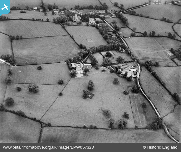
EPW057328 ENGLAND (1938). Shenley Park, Shenley Church End, 1938
© Hawlfraint cyfranwyr OpenStreetMap a thrwyddedwyd gan yr OpenStreetMap Foundation. 2026. Trwyddedir y gartograffeg fel CC BY-SA.
Delweddau cyfagos (9)
EPW057328

EPW056910

EPW056916

EPW056915

EPW057329

EPW056911

EPW056912

EPW056914

EPW056913

Manylion
| Pennawd | [EPW057328] Shenley Park, Shenley Church End, 1938 |
| Cyfeirnod | EPW057328 |
| Dyddiad | 3-June-1938 |
| Dolen | |
| Enw lle | SHENLEY CHURCH END |
| Plwyf | SHENLEY CHURCH END |
| Ardal | |
| Gwlad | ENGLAND |
| Dwyreiniad / Gogleddiad | 482767, 236714 |
| Hydred / Lledred | -0.79363695227371, 52.022240114433 |
| Cyfeirnod Grid Cenedlaethol | SP828367 |
