
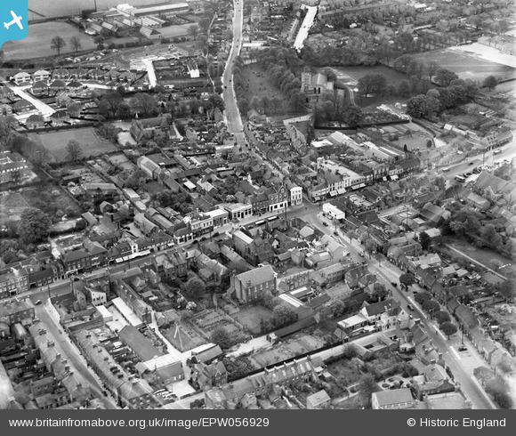
EPW056929 ENGLAND (1938). The junction of West Street, Church Street and High Street North and environs, Dunstable, 1938
© Hawlfraint cyfranwyr OpenStreetMap a thrwyddedwyd gan yr OpenStreetMap Foundation. 2026. Trwyddedir y gartograffeg fel CC BY-SA.
Delweddau cyfagos (9)
EPW056929

EPW023859

EPW056928

EPW014815

EPW023860

EPW056927

EPW023863

EPW023862

EPW056922

Manylion
| Pennawd | [EPW056929] The junction of West Street, Church Street and High Street North and environs, Dunstable, 1938 |
| Cyfeirnod | EPW056929 |
| Dyddiad | 26-April-1938 |
| Dolen | |
| Enw lle | DUNSTABLE |
| Plwyf | DUNSTABLE |
| Ardal | |
| Gwlad | ENGLAND |
| Dwyreiniad / Gogleddiad | 501891, 221888 |
| Hydred / Lledred | -0.51938525021283, 51.885789019594 |
| Cyfeirnod Grid Cenedlaethol | TL019219 |
Pinnau

rptomkins |
Friday 6th of August 2021 04:00:32 PM | |
|
Bluid |
Monday 30th of September 2019 09:47:51 AM | |
|
Bluid |
Monday 30th of September 2019 09:45:52 AM | |
|
Bluid |
Saturday 11th of March 2017 01:50:17 AM | |
|
Andrew |
Monday 19th of October 2015 09:37:52 PM |

