
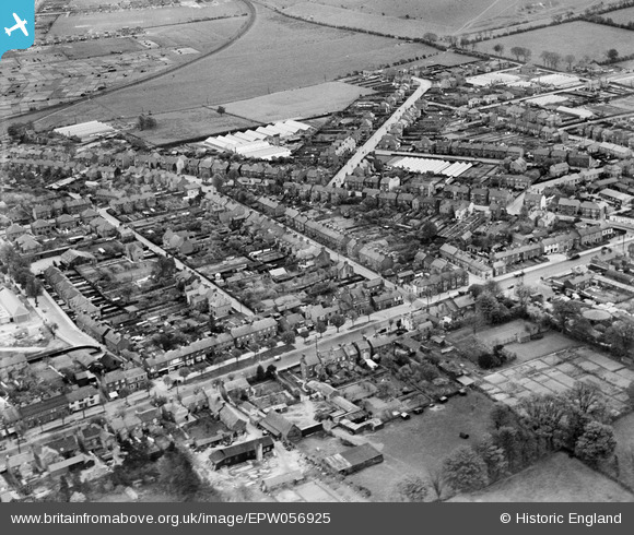
EPW056925 ENGLAND (1938). High Street South, Great Northern Road and environs, Dunstable, 1938
© Hawlfraint cyfranwyr OpenStreetMap a thrwyddedwyd gan yr OpenStreetMap Foundation. 2026. Trwyddedir y gartograffeg fel CC BY-SA.
Delweddau cyfagos (2)
EPW056925

EPW056926

Manylion
| Pennawd | [EPW056925] High Street South, Great Northern Road and environs, Dunstable, 1938 |
| Cyfeirnod | EPW056925 |
| Dyddiad | 26-April-1938 |
| Dolen | |
| Enw lle | DUNSTABLE |
| Plwyf | DUNSTABLE |
| Ardal | |
| Gwlad | ENGLAND |
| Dwyreiniad / Gogleddiad | 502430, 221451 |
| Hydred / Lledred | -0.51168545416053, 51.881762088317 |
| Cyfeirnod Grid Cenedlaethol | TL024215 |
Pinnau

Bluid |
Tuesday 25th of February 2014 01:30:07 PM |