
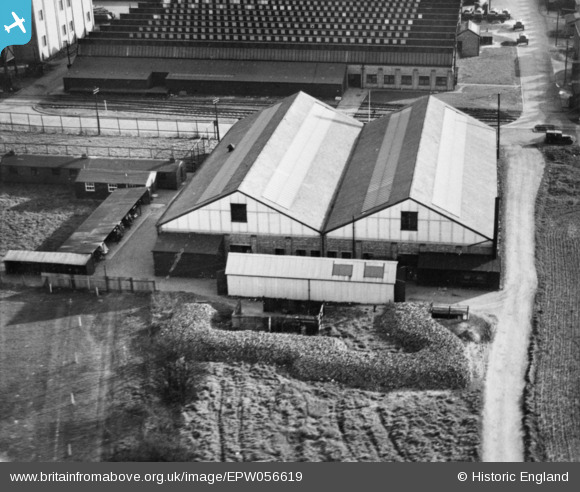
EPW056619 ENGLAND (1938). Part of the Slough Trading Estate on Fairlie Road, Slough, 1938. This image has been produced from a copy-negative.
© Hawlfraint cyfranwyr OpenStreetMap a thrwyddedwyd gan yr OpenStreetMap Foundation. 2026. Trwyddedir y gartograffeg fel CC BY-SA.
Delweddau cyfagos (13)
EPW056619

EPW015613

EPW000025

EPW015616

EPW025663

EAW015084

EPW015614

EPW000021

EPW025662

EPW025666

EPW025667

EPW025672

EPW025664

Manylion
| Pennawd | [EPW056619] Part of the Slough Trading Estate on Fairlie Road, Slough, 1938. This image has been produced from a copy-negative. |
| Cyfeirnod | EPW056619 |
| Dyddiad | 25-March-1938 |
| Dolen | |
| Enw lle | SLOUGH |
| Plwyf | |
| Ardal | |
| Gwlad | ENGLAND |
| Dwyreiniad / Gogleddiad | 495243, 181599 |
| Hydred / Lledred | -0.62696828161572, 51.52478323459 |
| Cyfeirnod Grid Cenedlaethol | SU952816 |
