
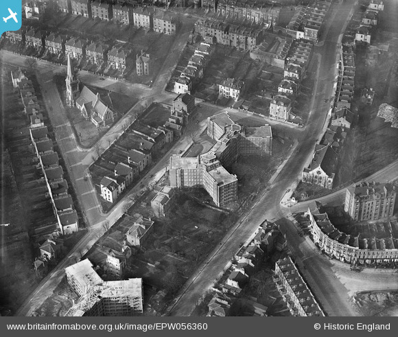
EPW056360 ENGLAND (1938). Eton Rise Flat Block and St Saviour's Church, Camden Town, 1938
© Hawlfraint cyfranwyr OpenStreetMap a thrwyddedwyd gan yr OpenStreetMap Foundation. 2026. Trwyddedir y gartograffeg fel CC BY-SA.
Delweddau cyfagos (30)
EPW056360

EPW056362

EPW056361

EPW056364

EPW058593

EPW060335

EPW058478

EPW060303
, Maitland Park, 1938")
EPW058475

EPW060304
, Maitland Park, 1938")
EPW060302
, Maitland Park, 1938")
EPW058473

EPW060334

EPW058476

EPW058474

EPW060333

EPW060332

EPW058477

EPW060331

EPW060305
, Maitland Park, 1938")
EPW060306
, Maitland Park, 1938")
EPW058594

EPW058591

EPW056358

EPW058592

EPW056365

EPW056363

EPW060330

EPW058590

EPW056359

Manylion
| Pennawd | [EPW056360] Eton Rise Flat Block and St Saviour's Church, Camden Town, 1938 |
| Cyfeirnod | EPW056360 |
| Dyddiad | 9-February-1938 |
| Dolen | |
| Enw lle | CAMDEN TOWN |
| Plwyf | |
| Ardal | |
| Gwlad | ENGLAND |
| Dwyreiniad / Gogleddiad | 527932, 184559 |
| Hydred / Lledred | -0.15487419338357, 51.544927433248 |
| Cyfeirnod Grid Cenedlaethol | TQ279846 |
Pinnau

Class31 |
Tuesday 15th of October 2013 09:14:02 AM | |
|
Class31 |
Tuesday 15th of October 2013 09:13:40 AM | |
|
Class31 |
Tuesday 15th of October 2013 09:13:21 AM | |
|
Class31 |
Tuesday 15th of October 2013 08:31:38 AM | |
|
Class31 |
Tuesday 15th of October 2013 08:31:38 AM |
Cyfraniadau Grŵp
View looking north west. |
Class31 |
Tuesday 15th of October 2013 09:14:40 AM |