
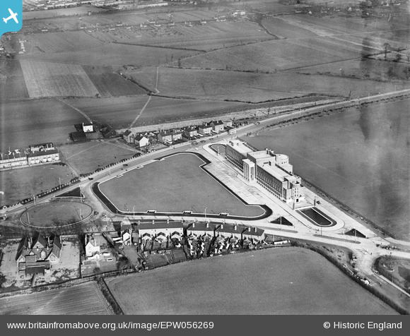
EPW056269 ENGLAND (1938). Dagenham Civic Centre, Dagenham, 1938
© Hawlfraint cyfranwyr OpenStreetMap a thrwyddedwyd gan yr OpenStreetMap Foundation. 2026. Trwyddedir y gartograffeg fel CC BY-SA.
Delweddau cyfagos (2)
EPW056269

EPW056270

Manylion
| Pennawd | [EPW056269] Dagenham Civic Centre, Dagenham, 1938 |
| Cyfeirnod | EPW056269 |
| Dyddiad | 17-January-1938 |
| Dolen | |
| Enw lle | DAGENHAM |
| Plwyf | |
| Ardal | |
| Gwlad | ENGLAND |
| Dwyreiniad / Gogleddiad | 549492, 186931 |
| Hydred / Lledred | 0.15686777131852, 51.560942635639 |
| Cyfeirnod Grid Cenedlaethol | TQ495869 |
Pinnau

powerpop |
Tuesday 18th of November 2014 05:43:42 PM | |
|
powerpop |
Tuesday 18th of November 2014 05:43:21 PM | |
|
powerpop |
Tuesday 18th of November 2014 05:42:31 PM | |
|
powerpop |
Tuesday 18th of November 2014 05:02:42 PM |