
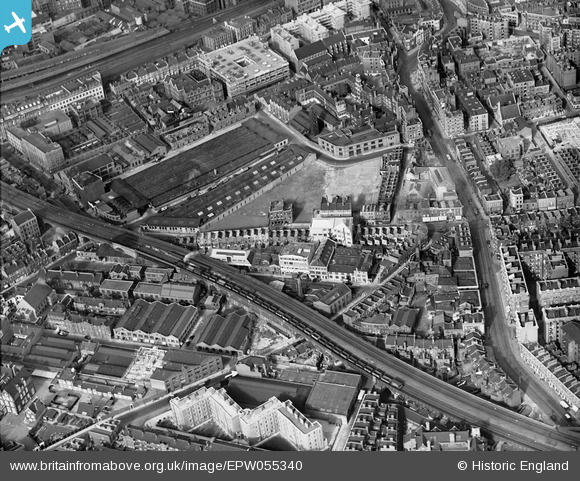
EPW055340 ENGLAND (1937). The residential and industrial area surrounding Webber Street and Southwark Bridge Road, The Borough, 1937
© Hawlfraint cyfranwyr OpenStreetMap a thrwyddedwyd gan yr OpenStreetMap Foundation. 2025. Trwyddedir y gartograffeg fel CC BY-SA.
Delweddau cyfagos (7)
EPW055340

EPW055337

EPW055335

EPW055338

EPW055339

EPW055336

EPR000212

Manylion
| Pennawd | [EPW055340] The residential and industrial area surrounding Webber Street and Southwark Bridge Road, The Borough, 1937 |
| Cyfeirnod | EPW055340 |
| Dyddiad | 8-September-1937 |
| Dolen | |
| Enw lle | THE BOROUGH |
| Plwyf | |
| Ardal | |
| Gwlad | ENGLAND |
| Dwyreiniad / Gogleddiad | 531968, 179796 |
| Hydred / Lledred | -0.098482530013286, 51.501190395673 |
| Cyfeirnod Grid Cenedlaethol | TQ320798 |
Pinnau

Chaz |
Tuesday 9th of February 2021 05:10:16 PM | |
|
Chaz |
Tuesday 9th of February 2021 05:05:21 PM | |
|
Fredk J Start |
Thursday 4th of December 2014 12:20:17 AM | |
|
courage |
Monday 21st of July 2014 10:03:54 AM | |
|
MB |
Friday 30th of May 2014 06:28:42 PM | |
|
MB |
Friday 30th of May 2014 06:27:57 PM | |

Alan McFaden |
Wednesday 7th of August 2013 05:09:40 PM | |
|
Alan McFaden |
Wednesday 7th of August 2013 09:23:35 AM |

