
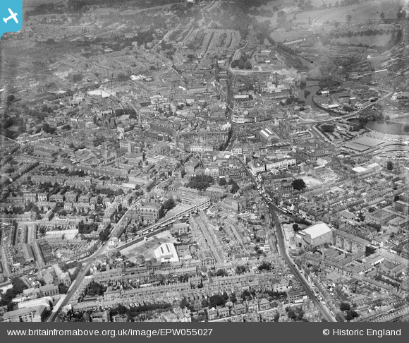
EPW055027 ENGLAND (1937). The city, Derby, from the south-east, 1937
© Hawlfraint cyfranwyr OpenStreetMap a thrwyddedwyd gan yr OpenStreetMap Foundation. 2026. Trwyddedir y gartograffeg fel CC BY-SA.
Delweddau cyfagos (11)
EPW055027

EPW057156

EPW057154

EPW057155

EAW004652

EAW004655

EAW004654

EPW005814

EAW004657

EPW055022

EPW041814

Manylion
| Pennawd | [EPW055027] The city, Derby, from the south-east, 1937 |
| Cyfeirnod | EPW055027 |
| Dyddiad | August-1937 |
| Dolen | |
| Enw lle | DERBY |
| Plwyf | |
| Ardal | |
| Gwlad | ENGLAND |
| Dwyreiniad / Gogleddiad | 435312, 335715 |
| Hydred / Lledred | -1.4747714770973, 52.917375175385 |
| Cyfeirnod Grid Cenedlaethol | SK353357 |
Pinnau

aremla |
Wednesday 14th of January 2026 03:47:45 PM | |
|
aremla |
Wednesday 14th of January 2026 03:44:47 PM | |
|
aremla |
Wednesday 14th of January 2026 03:42:57 PM | |
|
aremla |
Wednesday 14th of January 2026 03:41:00 PM | |
|
aremla |
Wednesday 14th of January 2026 03:40:16 PM | |
|
Andy Savage |
Tuesday 3rd of June 2025 12:36:52 PM | |
|
Andy Savage |
Tuesday 3rd of June 2025 12:35:06 PM | |
|
aremla |
Saturday 16th of December 2023 04:59:02 PM | |
|
aremla |
Saturday 16th of December 2023 04:57:40 PM | |
|
HelsyB |
Sunday 3rd of September 2023 04:24:44 PM | |
|
HelsyB |
Sunday 3rd of September 2023 04:22:00 PM | |
|
HelsyB |
Sunday 3rd of September 2023 04:20:55 PM |