
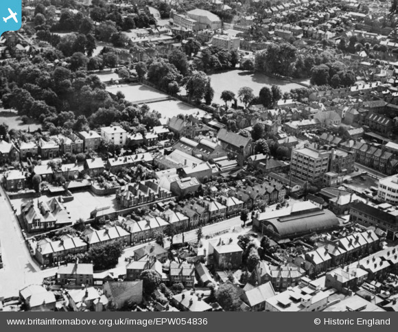
EPW054836 ENGLAND (1937). The Garstang Creameries Depot off The Bars and the surrounding area, Guildford, 1937. This image has been produced from a copy-negative.
© Hawlfraint cyfranwyr OpenStreetMap a thrwyddedwyd gan yr OpenStreetMap Foundation. 2026. Trwyddedir y gartograffeg fel CC BY-SA.
Delweddau cyfagos (19)
EPW054836

EPW054835

EPW054834

EAW014174

EAW014171

EAW014180

EAW014168

EAW014173

EAW014169

EAW014170

EAW014176

EAW014179

EAW022668

EAW014172

EAW014178

EPW022662

EPW016875

EAW014208

EAW022669

Manylion
| Pennawd | [EPW054836] The Garstang Creameries Depot off The Bars and the surrounding area, Guildford, 1937. This image has been produced from a copy-negative. |
| Cyfeirnod | EPW054836 |
| Dyddiad | 16-August-1937 |
| Dolen | |
| Enw lle | GUILDFORD |
| Plwyf | |
| Ardal | |
| Gwlad | ENGLAND |
| Dwyreiniad / Gogleddiad | 499816, 149811 |
| Hydred / Lledred | -0.57000021590342, 51.238223359963 |
| Cyfeirnod Grid Cenedlaethol | SU998498 |


