
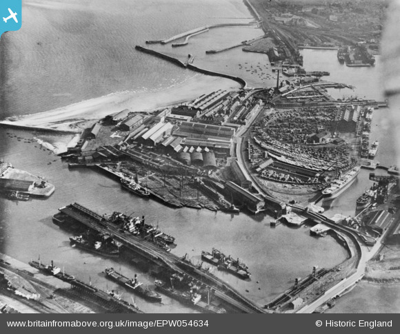
EPW054634 ENGLAND (1937). The Richardsons, Westgarth and Co Hartlepool Engine Works between Old Harbour and West Harbour, Hartlepool, 1937. This image has been produced from a copy-negative.
© Hawlfraint cyfranwyr OpenStreetMap a thrwyddedwyd gan yr OpenStreetMap Foundation. 2026. Trwyddedir y gartograffeg fel CC BY-SA.
Delweddau cyfagos (23)
EPW054634

EPW054633

EPW054635

EAW003203

EAW003187

EAW003190

EPW054630

EAW003193

EPW054631

EPW054577

EAW003192

EAW003200

EAW003201

EAW003199

EAW003191

EPW054636

EAW003186

EAW003189

EAW007973

EAW003204

EAW003197

EAW003185

EAW003194

Manylion
| Pennawd | [EPW054634] The Richardsons, Westgarth and Co Hartlepool Engine Works between Old Harbour and West Harbour, Hartlepool, 1937. This image has been produced from a copy-negative. |
| Cyfeirnod | EPW054634 |
| Dyddiad | 30-July-1937 |
| Dolen | |
| Enw lle | HARTLEPOOL |
| Plwyf | |
| Ardal | |
| Gwlad | ENGLAND |
| Dwyreiniad / Gogleddiad | 452065, 533756 |
| Hydred / Lledred | -1.1920927225754, 54.696033913897 |
| Cyfeirnod Grid Cenedlaethol | NZ521338 |
Pinnau
Byddwch y cyntaf i ychwanegu sylw at y ddelwedd hon!