
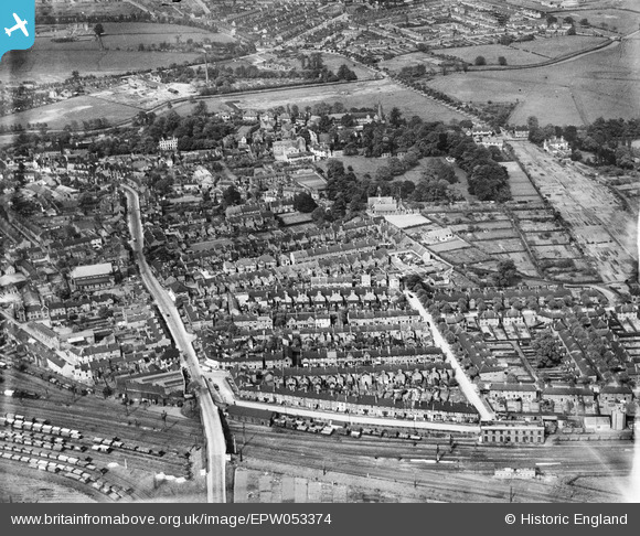
EPW053374 ENGLAND (1937). The residential area adjacent to Wolverhampton Road, Stafford, 1937
© Hawlfraint cyfranwyr OpenStreetMap a thrwyddedwyd gan yr OpenStreetMap Foundation. 2026. Trwyddedir y gartograffeg fel CC BY-SA.
Delweddau cyfagos (4)
EPW053374

EPW014105

EPW020051

EPW034023

Manylion
| Pennawd | [EPW053374] The residential area adjacent to Wolverhampton Road, Stafford, 1937 |
| Cyfeirnod | EPW053374 |
| Dyddiad | 30-May-1937 |
| Dolen | |
| Enw lle | STAFFORD |
| Plwyf | |
| Ardal | |
| Gwlad | ENGLAND |
| Dwyreiniad / Gogleddiad | 392446, 322461 |
| Hydred / Lledred | -2.1120528488381, 52.799323948525 |
| Cyfeirnod Grid Cenedlaethol | SJ924225 |
Pinnau

Ray Crowther |
Thursday 27th of February 2014 08:01:27 PM | |
|
Ray Crowther |
Thursday 27th of February 2014 08:00:07 PM | |

bescotbeast |
Sunday 15th of September 2013 04:19:41 AM | |
|
bescotbeast |
Sunday 15th of September 2013 04:19:11 AM | |
|
bescotbeast |
Sunday 15th of September 2013 04:18:38 AM | |
|
bescotbeast |
Sunday 15th of September 2013 04:18:12 AM |