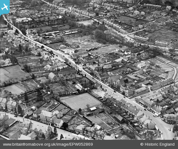
EPW052869 ENGLAND (1937). Marlowes and environs, Hemel Hempstead, 1937
    © Hawlfraint cyfranwyr OpenStreetMap a thrwyddedwyd gan yr OpenStreetMap Foundation. 2025. Trwyddedir y gartograffeg fel CC BY-SA.
  
Delweddau cyfagos (9)
Manylion
| Pennawd | [EPW052869] Marlowes and environs, Hemel Hempstead, 1937 | 
| Cyfeirnod | EPW052869 | 
| Dyddiad | 16-May-1937 | 
| Dolen | |
| Enw lle | HEMEL HEMPSTEAD | 
| Plwyf | |
| Ardal | |
| Gwlad | ENGLAND | 
| Dwyreiniad / Gogleddiad | 505504, 207411 | 
| Hydred / Lledred | -0.47131477234865, 51.754985955722 | 
| Cyfeirnod Grid Cenedlaethol | TL055074 | 
Pinnau
|  bury road |   H.E. | Monday 12th of January 2015 04:28:43 PM | 
|  cotterells |   H.E. | Monday 12th of January 2015 04:27:22 PM | 
|  lockers park lane |   H.E. | Monday 12th of January 2015 04:24:40 PM | 
|  collett road |   H.E. | Monday 12th of January 2015 04:23:23 PM | 
|  southhill road |   H.E. | Monday 12th of January 2015 04:20:30 PM | 
|  cotterells hill |   H.E. | Monday 12th of January 2015 04:17:53 PM | 
|  cemetery hill |   H.E. | Monday 12th of January 2015 04:14:36 PM | 
|  bridge street |   H.E. | Monday 12th of January 2015 04:13:15 PM | 
|  the white house |   H.E. | Monday 12th of January 2015 04:07:18 PM | 
|  methodist church |   H.E. | Monday 12th of January 2015 04:06:04 PM | 
| Now demolished (2014) |   downloader141 | Thursday 22nd of January 2015 12:42:55 PM | 
|  alma road |   H.E. | Monday 12th of January 2015 04:03:18 PM | 
|  bath street |   H.E. | Monday 12th of January 2015 03:59:53 PM | 
|  alexandra road |   H.E. | Monday 12th of January 2015 03:58:46 PM | 
|  furnville lane now midland road |   H.E. | Monday 12th of January 2015 03:57:59 PM | 
|  bury mill end school |   H.E. | Monday 12th of January 2015 03:54:16 PM | 
|  astley road |   H.E. | Monday 12th of January 2015 03:50:08 PM | 
|  astley road |   H.E. | Monday 12th of January 2015 03:50:08 PM | 
 
             
  ![[EPW052869] Marlowes and environs, Hemel Hempstead, 1937](http://britainfromabove.org.uk/sites/all/libraries/aerofilms-images/public/100x100/EPW/052/EPW052869.jpg) 
  
                                          ![[EAW017250] The town, Hemel Hempstead, 1948. This image has been produced from a print.](http://britainfromabove.org.uk/sites/all/libraries/aerofilms-images/public/100x100/EAW/017/EAW017250.jpg) 
 ![[EAW014884] The town, Hemel Hempstead, from the south-west, 1948. This image has been produced from a print.](http://britainfromabove.org.uk/sites/all/libraries/aerofilms-images/public/100x100/EAW/014/EAW014884.jpg) 
 ![[EPW052868] Marlowes, Alexander Road and environs, Hemel Hempstead, from the north, 1937](http://britainfromabove.org.uk/sites/all/libraries/aerofilms-images/public/100x100/EPW/052/EPW052868.jpg) 
 ![[EPW022456] The town centre, Hemel Hempstead, from the south-west, 1928](http://britainfromabove.org.uk/sites/all/libraries/aerofilms-images/public/100x100/EPW/022/EPW022456.jpg) 
 ![[EPW022457] The town centre, Hemel Hempstead, 1928](http://britainfromabove.org.uk/sites/all/libraries/aerofilms-images/public/100x100/EPW/022/EPW022457.jpg) 
 ![[EPW052865] The Junction of Marlowes and Bury Road (Queensway), Hemel Hempstead, 1937](http://britainfromabove.org.uk/sites/all/libraries/aerofilms-images/public/100x100/EPW/052/EPW052865.jpg) 
 ![[EPW052866] The Junction of Marlowes and Bury Road (Queensway) and environs, Hemel Hempstead, 1937](http://britainfromabove.org.uk/sites/all/libraries/aerofilms-images/public/100x100/EPW/052/EPW052866.jpg) 
 ![[EAW014883] Marlowes, Queensway and environs, Hemel Hempstead, 1948. This image has been produced from a print.](http://britainfromabove.org.uk/sites/all/libraries/aerofilms-images/public/100x100/EAW/014/EAW014883.jpg)