
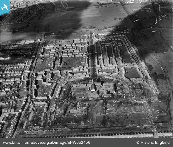
EPW052456 ENGLAND (1937). Housing estate under construction surrounding Cuckoo Avenue and Westcott Crescent and the Hanwell Community Centre, Greenford, 1937
© Hawlfraint cyfranwyr OpenStreetMap a thrwyddedwyd gan yr OpenStreetMap Foundation. 2026. Trwyddedir y gartograffeg fel CC BY-SA.
Delweddau cyfagos (10)
EPW052456

EPW052450

EPW052458

EPW052455

EPW052453

EPW052454

EPW052457

EPW052451

EPW052452

EPW052459

Manylion
| Pennawd | [EPW052456] Housing estate under construction surrounding Cuckoo Avenue and Westcott Crescent and the Hanwell Community Centre, Greenford, 1937 |
| Cyfeirnod | EPW052456 |
| Dyddiad | 6-February-1937 |
| Dolen | |
| Enw lle | GREENFORD |
| Plwyf | |
| Ardal | |
| Gwlad | ENGLAND |
| Dwyreiniad / Gogleddiad | 515509, 181702 |
| Hydred / Lledred | -0.33489910489437, 51.521927002318 |
| Cyfeirnod Grid Cenedlaethol | TQ155817 |
Pinnau
Byddwch y cyntaf i ychwanegu sylw at y ddelwedd hon!