
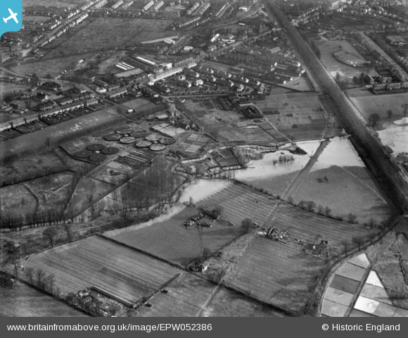
EPW052386 ENGLAND (1937). The River Hogsmill in flood by the Maldens and Coombe Urban District Council Sewage Works and environs, Norbiton, 1937. This image has been produced from a print.
© Hawlfraint cyfranwyr OpenStreetMap a thrwyddedwyd gan yr OpenStreetMap Foundation. 2026. Trwyddedir y gartograffeg fel CC BY-SA.
Delweddau cyfagos (11)
EPW052386

EPW056179

EPW056175

EPW056180

EPW056181

EPW056178

EPW056176

EPW056177

EPW017482

EPW017481

EPW017484

Manylion
| Pennawd | [EPW052386] The River Hogsmill in flood by the Maldens and Coombe Urban District Council Sewage Works and environs, Norbiton, 1937. This image has been produced from a print. |
| Cyfeirnod | EPW052386 |
| Dyddiad | 21-January-1937 |
| Dolen | |
| Enw lle | NORBITON |
| Plwyf | |
| Ardal | |
| Gwlad | ENGLAND |
| Dwyreiniad / Gogleddiad | 519816, 168375 |
| Hydred / Lledred | -0.27735907666036, 51.401239992973 |
| Cyfeirnod Grid Cenedlaethol | TQ198684 |
Pinnau
Byddwch y cyntaf i ychwanegu sylw at y ddelwedd hon!