
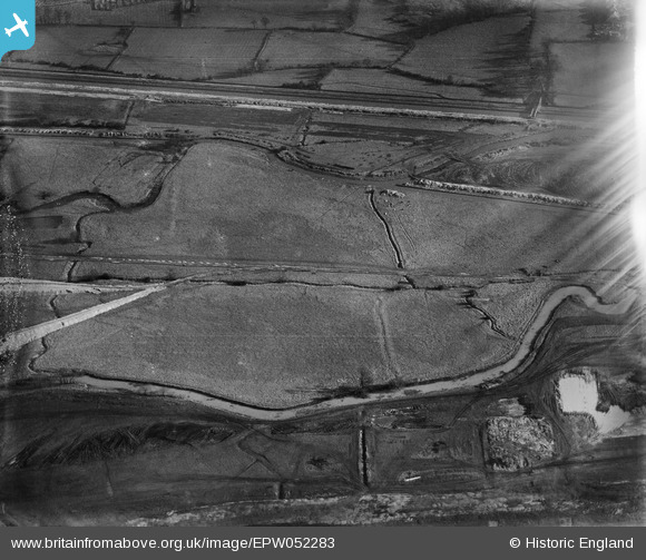
EPW052283 ENGLAND (1936). The site of the William Girling Reservoir showing preliminary construction works, Edmonton, 1936. This image has been affected by flare.
© Hawlfraint cyfranwyr OpenStreetMap a thrwyddedwyd gan yr OpenStreetMap Foundation. 2026. Trwyddedir y gartograffeg fel CC BY-SA.
Delweddau cyfagos (21)
EPW052283

EPW052280

EPW056820

EPW060631

EPW058470
 Reservoir under construction, Edmonton, 1938")
EAW040970

EPW055979

EPW056813

EPW056334

EPW053854
 Reservoir under construction, Edmonton, 1937")
EPW050858

EPW053851
 Reservoir under construction, Edmonton, 1937")
EPW056829

EPW058462
 Reservoir under construction, Edmonton, 1938")
EPW055976

EPW060222
 Reservoir under construction, Edmonton, 1938")
EPW056332

EAW040971

EPW052264

EPW050864

EPW056333

Manylion
| Pennawd | [EPW052283] The site of the William Girling Reservoir showing preliminary construction works, Edmonton, 1936. This image has been affected by flare. |
| Cyfeirnod | EPW052283 |
| Dyddiad | November-1936 |
| Dolen | |
| Enw lle | EDMONTON |
| Plwyf | |
| Ardal | |
| Gwlad | ENGLAND |
| Dwyreiniad / Gogleddiad | 536793, 194255 |
| Hydred / Lledred | -0.023374413404402, 51.629987070378 |
| Cyfeirnod Grid Cenedlaethol | TQ368943 |
Pinnau
Byddwch y cyntaf i ychwanegu sylw at y ddelwedd hon!