
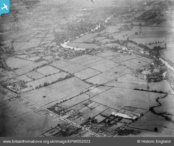
EPW052023 ENGLAND (1936). Fields between Dorney Reach and the Bray Court Hotel prior to the construction of the Maidenhead by-pass, Bray Wick, from the south-east, 1936
© Hawlfraint cyfranwyr OpenStreetMap a thrwyddedwyd gan yr OpenStreetMap Foundation. 2026. Trwyddedir y gartograffeg fel CC BY-SA.
Delweddau cyfagos (3)
EPW052023

EPW052024

EAW003802

Manylion
| Pennawd | [EPW052023] Fields between Dorney Reach and the Bray Court Hotel prior to the construction of the Maidenhead by-pass, Bray Wick, from the south-east, 1936 |
| Cyfeirnod | EPW052023 |
| Dyddiad | October-1936 |
| Dolen | |
| Enw lle | BRAY WICK |
| Plwyf | BRAY |
| Ardal | |
| Gwlad | ENGLAND |
| Dwyreiniad / Gogleddiad | 490942, 178552 |
| Hydred / Lledred | -0.68974020449399, 51.498099461346 |
| Cyfeirnod Grid Cenedlaethol | SU909786 |
Pinnau
Byddwch y cyntaf i ychwanegu sylw at y ddelwedd hon!