
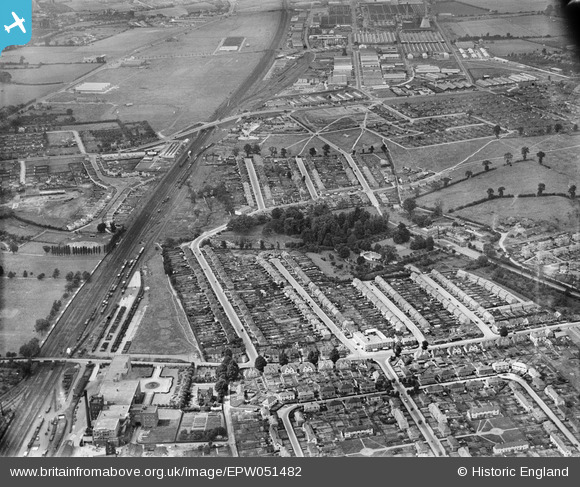
EPW051482 ENGLAND (1936). Housing development around Baylis House and environs, Slough, 1936
© Hawlfraint cyfranwyr OpenStreetMap a thrwyddedwyd gan yr OpenStreetMap Foundation. 2026. Trwyddedir y gartograffeg fel CC BY-SA.
Delweddau cyfagos (2)
EPW051482

EPW051481

Manylion
| Pennawd | [EPW051482] Housing development around Baylis House and environs, Slough, 1936 |
| Cyfeirnod | EPW051482 |
| Dyddiad | August-1936 |
| Dolen | |
| Enw lle | SLOUGH |
| Plwyf | |
| Ardal | |
| Gwlad | ENGLAND |
| Dwyreiniad / Gogleddiad | 496870, 180685 |
| Hydred / Lledred | -0.60377206213807, 51.516289753917 |
| Cyfeirnod Grid Cenedlaethol | SU969807 |
Pinnau
 |

Class31 |
Tuesday 16th of July 2013 10:38:14 PM |

Mike Holder |
Saturday 18th of May 2013 02:43:37 PM | |
|
dave43 |
Monday 13th of May 2013 09:32:34 PM | |
|
dave43 |
Sunday 12th of May 2013 10:05:13 PM |
Cyfraniadau Grŵp

Baylis Road looking west from the junction with Stoke Poges Lane. Photograph taken today. |
Class31 |
Tuesday 16th of July 2013 10:35:36 PM |