
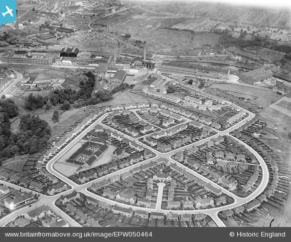
EPW050464 ENGLAND (1936). Housing at St Anne's Park and the St Anne's Board Mill Co Ltd Works, Bristol, 1936
© Hawlfraint cyfranwyr OpenStreetMap a thrwyddedwyd gan yr OpenStreetMap Foundation. 2026. Trwyddedir y gartograffeg fel CC BY-SA.
Delweddau cyfagos (15)
EPW050464

EPW050563

EPW050467

EPW050560

EPW060108

EPW050465

EPW050557

EPW060107

EPW050558

EPW048311

EPW060111

EPW050466

EPW060112

EPW050571

EPW050565

Manylion
| Pennawd | [EPW050464] Housing at St Anne's Park and the St Anne's Board Mill Co Ltd Works, Bristol, 1936 |
| Cyfeirnod | EPW050464 |
| Dyddiad | June-1936 |
| Dolen | |
| Enw lle | BRISTOL |
| Plwyf | |
| Ardal | |
| Gwlad | ENGLAND |
| Dwyreiniad / Gogleddiad | 362334, 172647 |
| Hydred / Lledred | -2.5421116461225, 51.451063710073 |
| Cyfeirnod Grid Cenedlaethol | ST623726 |
