
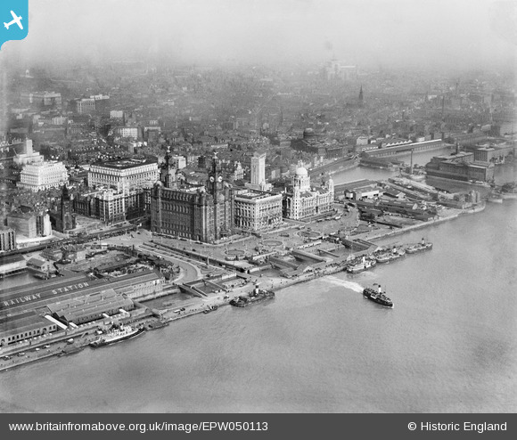
EPW050113 ENGLAND (1936). The Royal Liver Building and the Port of Liverpool Building alongside George's Pierhead, Liverpool, from the west, 1936
© Hawlfraint cyfranwyr OpenStreetMap a thrwyddedwyd gan yr OpenStreetMap Foundation. 2026. Trwyddedir y gartograffeg fel CC BY-SA.
Delweddau cyfagos (19)
EPW050113

EAW366628

EPW003064

EAW108229

EPW023593

EPW023592

EAW001917

EPW011192

EPW003060

EPW003065

EAW001915

EPW045195

EAW001921

EAW043395

EAW023374

EAW670571

EPW045196

EPW045194

EPW045193

Manylion
| Pennawd | [EPW050113] The Royal Liver Building and the Port of Liverpool Building alongside George's Pierhead, Liverpool, from the west, 1936 |
| Cyfeirnod | EPW050113 |
| Dyddiad | May-1936 |
| Dolen | |
| Enw lle | LIVERPOOL |
| Plwyf | |
| Ardal | |
| Gwlad | ENGLAND |
| Dwyreiniad / Gogleddiad | 333657, 390366 |
| Hydred / Lledred | -2.9980553140438, 53.405676156407 |
| Cyfeirnod Grid Cenedlaethol | SJ337904 |
Pinnau

Bottom Yard |
Sunday 11th of May 2025 05:06:00 PM | |
|
Phil |
Monday 3rd of February 2025 04:30:16 PM | |
|
davec |
Saturday 6th of June 2020 10:50:27 AM | |
|
DFoxwell |
Saturday 12th of April 2014 06:27:47 PM | |
|
Brian Notts |
Monday 25th of November 2013 02:17:51 AM | |
|
BruceR |
Sunday 27th of October 2013 10:16:46 PM |