
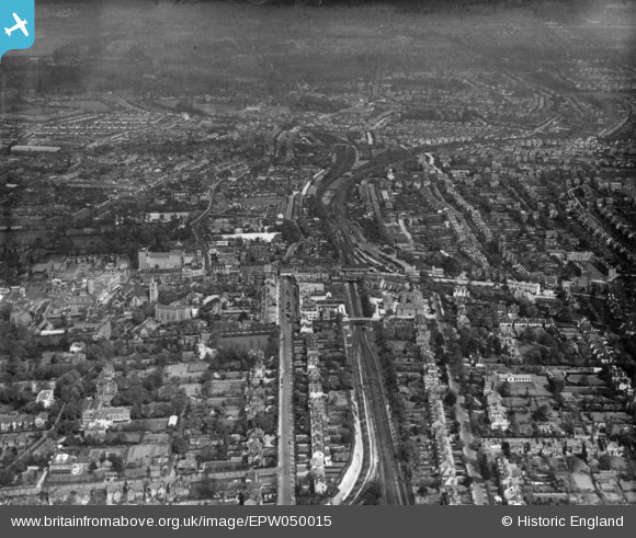
EPW050015 ENGLAND (1936). Sutton Junction and the town, Sutton, from the west, 1936. This image has been produced from a print.
© Hawlfraint cyfranwyr OpenStreetMap a thrwyddedwyd gan yr OpenStreetMap Foundation. 2026. Trwyddedir y gartograffeg fel CC BY-SA.
Delweddau cyfagos (6)
EPW050015

EPW001675

EPW028240

EPW057035

EPW057036

EPW050016

Manylion
| Pennawd | [EPW050015] Sutton Junction and the town, Sutton, from the west, 1936. This image has been produced from a print. |
| Cyfeirnod | EPW050015 |
| Dyddiad | May-1936 |
| Dolen | |
| Enw lle | SUTTON |
| Plwyf | |
| Ardal | |
| Gwlad | ENGLAND |
| Dwyreiniad / Gogleddiad | 525699, 163790 |
| Hydred / Lledred | -0.19444371217311, 51.358755614856 |
| Cyfeirnod Grid Cenedlaethol | TQ257638 |
Pinnau

John W |
Friday 23rd of December 2016 09:24:54 PM | |
|
John W |
Friday 23rd of December 2016 09:23:17 PM | |
|
John W |
Friday 23rd of December 2016 09:20:49 PM | |
|
John W |
Friday 23rd of December 2016 09:19:35 PM | |
|
John W |
Friday 23rd of December 2016 09:18:12 PM |