
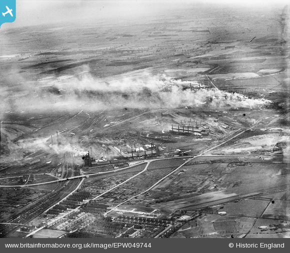
EPW049744 ENGLAND (1936). The Steelworks, Scunthorpe, from the south-west, 1936
© Hawlfraint cyfranwyr OpenStreetMap a thrwyddedwyd gan yr OpenStreetMap Foundation. 2026. Trwyddedir y gartograffeg fel CC BY-SA.
Delweddau cyfagos (2)
EPW049744

EPW049745

Manylion
| Pennawd | [EPW049744] The Steelworks, Scunthorpe, from the south-west, 1936 |
| Cyfeirnod | EPW049744 |
| Dyddiad | March-1936 |
| Dolen | |
| Enw lle | SCUNTHORPE |
| Plwyf | |
| Ardal | |
| Gwlad | ENGLAND |
| Dwyreiniad / Gogleddiad | 490509, 410814 |
| Hydred / Lledred | -0.63259221877751, 53.585849535056 |
| Cyfeirnod Grid Cenedlaethol | SE905108 |
Pinnau

The Cornish Northerner |
Thursday 24th of September 2015 01:57:55 AM | |
|
The Cornish Northerner |
Thursday 24th of September 2015 01:57:29 AM | |
|
The Cornish Northerner |
Thursday 24th of September 2015 01:56:30 AM | |
|
The Cornish Northerner |
Thursday 24th of September 2015 01:55:39 AM | |
|
The Cornish Northerner |
Thursday 24th of September 2015 01:53:25 AM | |
|
The Cornish Northerner |
Thursday 24th of September 2015 01:52:59 AM |