
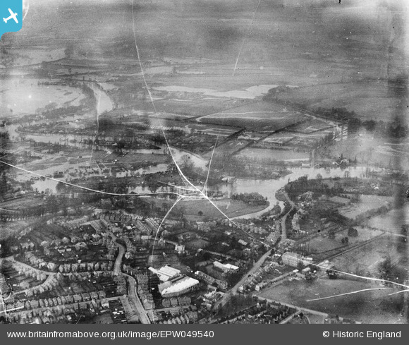
EPW049540 ENGLAND (1936). Flooding around the Wey Navigation and the River Thames, Weybridge, from the south-east, 1936. This image has been produced from a damaged negative.
© Hawlfraint cyfranwyr OpenStreetMap a thrwyddedwyd gan yr OpenStreetMap Foundation. 2026. Trwyddedir y gartograffeg fel CC BY-SA.
Delweddau cyfagos (2)
EPW049540

EPW023384

Manylion
| Pennawd | [EPW049540] Flooding around the Wey Navigation and the River Thames, Weybridge, from the south-east, 1936. This image has been produced from a damaged negative. |
| Cyfeirnod | EPW049540 |
| Dyddiad | January-1936 |
| Dolen | |
| Enw lle | WEYBRIDGE |
| Plwyf | |
| Ardal | |
| Gwlad | ENGLAND |
| Dwyreiniad / Gogleddiad | 507539, 165315 |
| Hydred / Lledred | -0.45472433413232, 51.376193467884 |
| Cyfeirnod Grid Cenedlaethol | TQ075653 |
Pinnau
Byddwch y cyntaf i ychwanegu sylw at y ddelwedd hon!