
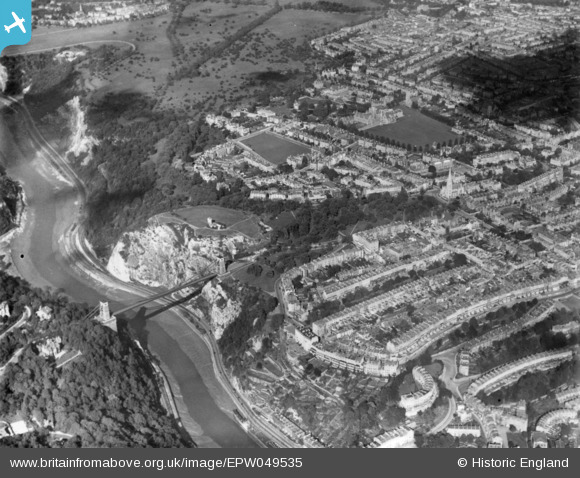
EPW049535 ENGLAND (1935). The Clifton Suspension Bridge, Observatory Hill and environs, Clifton, 1935. This image has been produced from a print.
© Hawlfraint cyfranwyr OpenStreetMap a thrwyddedwyd gan yr OpenStreetMap Foundation. 2026. Trwyddedir y gartograffeg fel CC BY-SA.
Delweddau cyfagos (13)
EPW049535

EPW048299

EPW032526

EPW048295

EAW015138

EAW033327

EPW041480

EPW037150

EPW048292

EPW012024

EAW033323

EPW001274

EAW050560

Manylion
| Pennawd | [EPW049535] The Clifton Suspension Bridge, Observatory Hill and environs, Clifton, 1935. This image has been produced from a print. |
| Cyfeirnod | EPW049535 |
| Dyddiad | December-1935 |
| Dolen | |
| Enw lle | CLIFTON |
| Plwyf | |
| Ardal | |
| Gwlad | ENGLAND |
| Dwyreiniad / Gogleddiad | 356700, 173270 |
| Hydred / Lledred | -2.623271013065, 51.456262825106 |
| Cyfeirnod Grid Cenedlaethol | ST567733 |
Pinnau
Byddwch y cyntaf i ychwanegu sylw at y ddelwedd hon!