
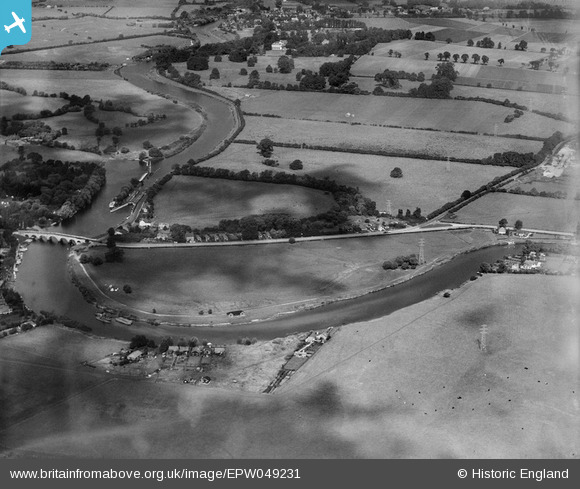
EPW049231 ENGLAND (1935). Chertsey Bridge Road and the Sports Ground, Chertsey, from the south-east, 1935
© Hawlfraint cyfranwyr OpenStreetMap a thrwyddedwyd gan yr OpenStreetMap Foundation. 2026. Trwyddedir y gartograffeg fel CC BY-SA.
Delweddau cyfagos (5)
EPW049231

EPW049232

EPW049233

EPW049234

EPW058804

Manylion
| Pennawd | [EPW049231] Chertsey Bridge Road and the Sports Ground, Chertsey, from the south-east, 1935 |
| Cyfeirnod | EPW049231 |
| Dyddiad | September-1935 |
| Dolen | |
| Enw lle | CHERTSEY |
| Plwyf | |
| Ardal | |
| Gwlad | ENGLAND |
| Dwyreiniad / Gogleddiad | 505790, 166430 |
| Hydred / Lledred | -0.47951475428413, 51.386545456011 |
| Cyfeirnod Grid Cenedlaethol | TQ058664 |
Pinnau

bumblee |
Friday 12th of December 2014 02:40:40 PM |