
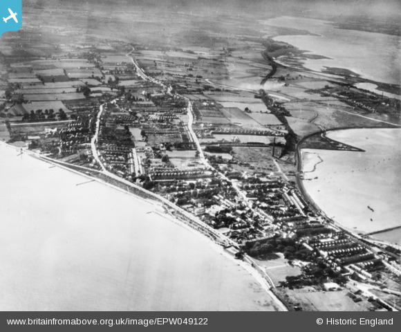
EPW049122 ENGLAND (1935). Dovercourt, Harwich, from the east, 1935. This image has been produced from a copy-negative.
© Hawlfraint cyfranwyr OpenStreetMap a thrwyddedwyd gan yr OpenStreetMap Foundation. 2026. Trwyddedir y gartograffeg fel CC BY-SA.
Delweddau cyfagos (4)
EPW049122

EAW025900

EAW043681

EPW049041

Manylion
| Pennawd | [EPW049122] Dovercourt, Harwich, from the east, 1935. This image has been produced from a copy-negative. |
| Cyfeirnod | EPW049122 |
| Dyddiad | August-1935 |
| Dolen | |
| Enw lle | HARWICH |
| Plwyf | HARWICH |
| Ardal | |
| Gwlad | ENGLAND |
| Dwyreiniad / Gogleddiad | 625752, 231489 |
| Hydred / Lledred | 1.2844588860875, 51.935604408108 |
| Cyfeirnod Grid Cenedlaethol | TM258315 |
Pinnau
Byddwch y cyntaf i ychwanegu sylw at y ddelwedd hon!