
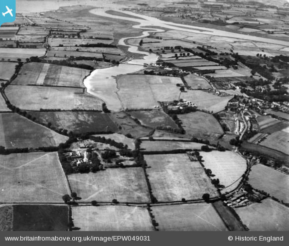
EPW049031 ENGLAND (1935). The Mill Dam, Warren Farm and environs, St Osyth, 1935. This image has been produced from a print.
© Hawlfraint cyfranwyr OpenStreetMap a thrwyddedwyd gan yr OpenStreetMap Foundation. 2026. Trwyddedir y gartograffeg fel CC BY-SA.
Delweddau cyfagos (2)
EPW049031

EPW011632

Manylion
| Pennawd | [EPW049031] The Mill Dam, Warren Farm and environs, St Osyth, 1935. This image has been produced from a print. |
| Cyfeirnod | EPW049031 |
| Dyddiad | August-1935 |
| Dolen | |
| Enw lle | ST OSYTH |
| Plwyf | ST. OSYTH |
| Ardal | |
| Gwlad | ENGLAND |
| Dwyreiniad / Gogleddiad | 612326, 215129 |
| Hydred / Lledred | 1.0793834569, 51.793993870454 |
| Cyfeirnod Grid Cenedlaethol | TM123151 |
Pinnau
Byddwch y cyntaf i ychwanegu sylw at y ddelwedd hon!