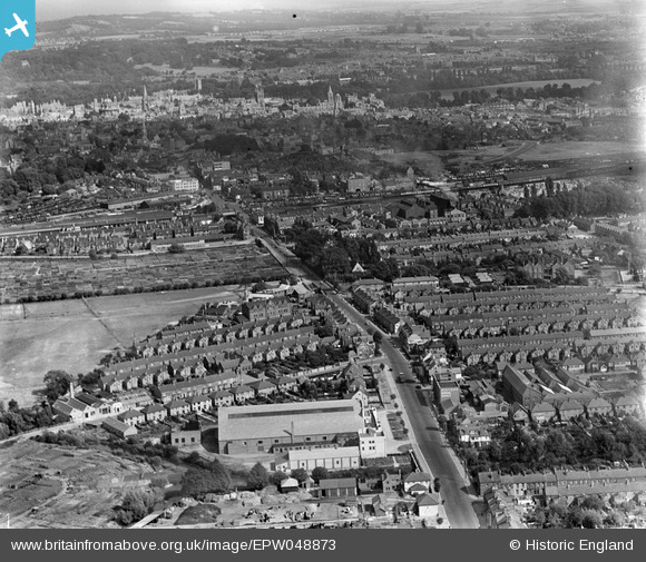
EPW048873 ENGLAND (1935). Botley Road and the city, Oxford, from the west, 1935
    © Hawlfraint cyfranwyr OpenStreetMap a thrwyddedwyd gan yr OpenStreetMap Foundation. 2025. Trwyddedir y gartograffeg fel CC BY-SA.
  
Delweddau cyfagos (5)
Manylion
| Pennawd | [EPW048873] Botley Road and the city, Oxford, from the west, 1935 | 
| Cyfeirnod | EPW048873 | 
| Dyddiad | August-1935 | 
| Dolen | |
| Enw lle | OXFORD | 
| Plwyf | |
| Ardal | |
| Gwlad | ENGLAND | 
| Dwyreiniad / Gogleddiad | 449870, 206279 | 
| Hydred / Lledred | -1.2774704551801, 51.752526952596 | 
| Cyfeirnod Grid Cenedlaethol | SP499063 | 
Pinnau
|  West Oxford Community Primary |   NickPStanton | Thursday 22nd of October 2020 09:11:51 PM | 
 
             
  ![[EPW048873] Botley Road and the city, Oxford, from the west, 1935](http://britainfromabove.org.uk/sites/all/libraries/aerofilms-images/public/100x100/EPW/048/EPW048873.jpg) 
  
                                          ![[EPW048871] Botley Road and environs, Oxford, 1935](http://britainfromabove.org.uk/sites/all/libraries/aerofilms-images/public/100x100/EPW/048/EPW048871.jpg) 
 ![[EPW048869] Botley Road and the city, Oxford, from the south-west, 1935](http://britainfromabove.org.uk/sites/all/libraries/aerofilms-images/public/100x100/EPW/048/EPW048869.jpg) 
 ![[EPW048872] Botley Road and environs, Oxford, 1935](http://britainfromabove.org.uk/sites/all/libraries/aerofilms-images/public/100x100/EPW/048/EPW048872.jpg) 
 ![[EPW048870] Botley Road and the city, Oxford, from the west, 1935](http://britainfromabove.org.uk/sites/all/libraries/aerofilms-images/public/100x100/EPW/048/EPW048870.jpg)