
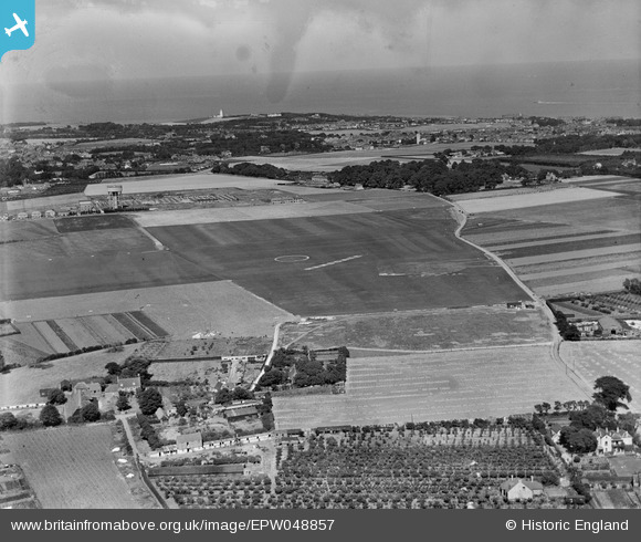
EPW048857 ENGLAND (1935). Ramsgate Airport and environs, Ramsgate, from the south-west, 1935
© Hawlfraint cyfranwyr OpenStreetMap a thrwyddedwyd gan yr OpenStreetMap Foundation. 2026. Trwyddedir y gartograffeg fel CC BY-SA.
Delweddau cyfagos (5)
EPW048857

EPW053975
 and a BAC Drone (G-AEEN) outside the Ramsgate Aerodrome Pavilion, Northwood, from the north-east, 1937")
EPW053974
 and a BAC Drone (G-AEEN) outside the Ramsgate Aerodrome Pavilion, Northwood, from the north-east, 1937")
EPW052881

EPW043762

Manylion
| Pennawd | [EPW048857] Ramsgate Airport and environs, Ramsgate, from the south-west, 1935 |
| Cyfeirnod | EPW048857 |
| Dyddiad | August-1935 |
| Dolen | |
| Enw lle | RAMSGATE |
| Plwyf | RAMSGATE |
| Ardal | |
| Gwlad | ENGLAND |
| Dwyreiniad / Gogleddiad | 637292, 167097 |
| Hydred / Lledred | 1.4083686491208, 51.352811457385 |
| Cyfeirnod Grid Cenedlaethol | TR373671 |
