
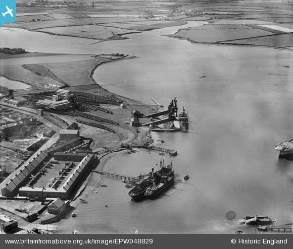
EPW048829 ENGLAND (1935). Cowpen Colliery (Bates Pit) railway sidings and staiths, and the River Blyth and surrounding countryside, Blyth, from the east, 1935
© Hawlfraint cyfranwyr OpenStreetMap a thrwyddedwyd gan yr OpenStreetMap Foundation. 2026. Trwyddedir y gartograffeg fel CC BY-SA.
Delweddau cyfagos (6)
EPW048829
 railway sidings and staiths, and the River Blyth and surrounding countryside, Blyth, from the east, 1935")
EPW048833
 railway sidings and staiths, the River Blyth and Battleship Wharf, Blyth, 1935")
EPW048831

EPW048835

EAW013067

EAW013069

Manylion
| Pennawd | [EPW048829] Cowpen Colliery (Bates Pit) railway sidings and staiths, and the River Blyth and surrounding countryside, Blyth, from the east, 1935 |
| Cyfeirnod | EPW048829 |
| Dyddiad | August-1935 |
| Dolen | |
| Enw lle | BLYTH |
| Plwyf | BLYTH |
| Ardal | |
| Gwlad | ENGLAND |
| Dwyreiniad / Gogleddiad | 430931, 582389 |
| Hydred / Lledred | -1.5147880287065, 55.134842052887 |
| Cyfeirnod Grid Cenedlaethol | NZ309824 |
Pinnau
Byddwch y cyntaf i ychwanegu sylw at y ddelwedd hon!