
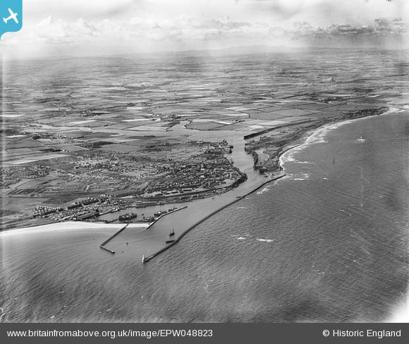
EPW048823 ENGLAND (1935). The harbour, town and surrounding countryside, Blyth, from the south-east, 1935
© Hawlfraint cyfranwyr OpenStreetMap a thrwyddedwyd gan yr OpenStreetMap Foundation. 2026. Trwyddedir y gartograffeg fel CC BY-SA.
Delweddau cyfagos (2)
EPW048823

EPW048838

Manylion
| Pennawd | [EPW048823] The harbour, town and surrounding countryside, Blyth, from the south-east, 1935 |
| Cyfeirnod | EPW048823 |
| Dyddiad | August-1935 |
| Dolen | |
| Enw lle | BLYTH |
| Plwyf | EAST BEDLINGTON |
| Ardal | |
| Gwlad | ENGLAND |
| Dwyreiniad / Gogleddiad | 432452, 581033 |
| Hydred / Lledred | -1.4910842664285, 55.122558809197 |
| Cyfeirnod Grid Cenedlaethol | NZ325810 |
Pinnau
Byddwch y cyntaf i ychwanegu sylw at y ddelwedd hon!