
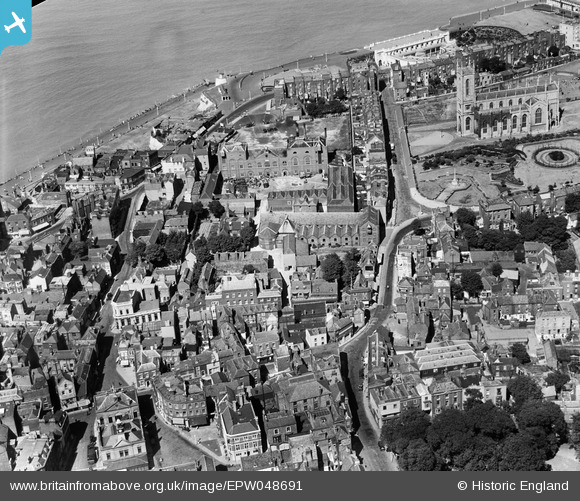
EPW048691 ENGLAND (1935). The Cobb and Co Brewery below Trinity Church and environs, Margate, 1935. This image has been produced from a damaged negative.
© Hawlfraint cyfranwyr OpenStreetMap a thrwyddedwyd gan yr OpenStreetMap Foundation. 2026. Trwyddedir y gartograffeg fel CC BY-SA.
Delweddau cyfagos (25)
EPW048691

EPW048692

EPW048685

EPW048690

EPW048688

EPW048684

EPW048689

EPW048687

EPW048846

EPW048686

EPW000624

EPW000636

EPW018600

EPW000625

EPW048845

EPW018599

EPW009241

EPW048847

EPW000631

EPW000633

EPW018607

EPW035470

EPW000627

EPW000638

EAW015840

Manylion
| Pennawd | [EPW048691] The Cobb and Co Brewery below Trinity Church and environs, Margate, 1935. This image has been produced from a damaged negative. |
| Cyfeirnod | EPW048691 |
| Dyddiad | July-1935 |
| Dolen | |
| Enw lle | MARGATE |
| Plwyf | |
| Ardal | |
| Gwlad | ENGLAND |
| Dwyreiniad / Gogleddiad | 635495, 171127 |
| Hydred / Lledred | 1.3852757113942, 51.389736322655 |
| Cyfeirnod Grid Cenedlaethol | TR355711 |
Pinnau
Byddwch y cyntaf i ychwanegu sylw at y ddelwedd hon!