
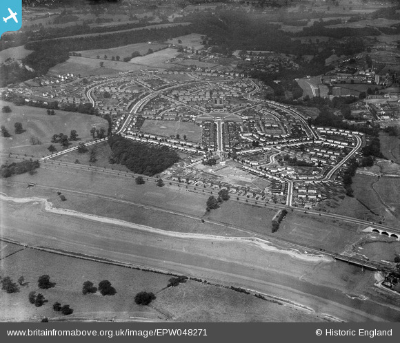
EPW048271 ENGLAND (1935). The residential area surrounding St Edyth's Road and Sylvan Way alongside the River Avon, Sea Mills, 1935
© Hawlfraint cyfranwyr OpenStreetMap a thrwyddedwyd gan yr OpenStreetMap Foundation. 2026. Trwyddedir y gartograffeg fel CC BY-SA.
Delweddau cyfagos (2)
EPW048271

EPW048270

Manylion
| Pennawd | [EPW048271] The residential area surrounding St Edyth's Road and Sylvan Way alongside the River Avon, Sea Mills, 1935 |
| Cyfeirnod | EPW048271 |
| Dyddiad | July-1935 |
| Dolen | |
| Enw lle | SEA MILLS |
| Plwyf | |
| Ardal | |
| Gwlad | ENGLAND |
| Dwyreiniad / Gogleddiad | 354893, 176458 |
| Hydred / Lledred | -2.6496867075846, 51.484788103289 |
| Cyfeirnod Grid Cenedlaethol | ST549765 |
Pinnau

Donal Lucey |
Tuesday 4th of March 2025 06:15:16 PM | |
|
Donal Lucey |
Tuesday 4th of March 2025 06:15:01 PM | |
|
Donal Lucey |
Tuesday 4th of March 2025 06:14:18 PM | |
|
Donal Lucey |
Tuesday 4th of March 2025 06:13:48 PM | |
|
Donal Lucey |
Tuesday 4th of March 2025 06:13:21 PM |