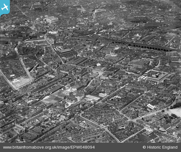
EPW048094 ENGLAND (1935). The Digbeth area, Birmingham, from the south-east 1935
    © Hawlfraint cyfranwyr OpenStreetMap a thrwyddedwyd gan yr OpenStreetMap Foundation. 2025. Trwyddedir y gartograffeg fel CC BY-SA.
  
Manylion
| Pennawd | [EPW048094] The Digbeth area, Birmingham, from the south-east 1935 | 
| Cyfeirnod | EPW048094 | 
| Dyddiad | July-1935 | 
| Dolen | |
| Enw lle | BIRMINGHAM | 
| Plwyf | |
| Ardal | |
| Gwlad | ENGLAND | 
| Dwyreiniad / Gogleddiad | 407584, 285893 | 
| Hydred / Lledred | -1.8883423043366, 52.470549611615 | 
| Cyfeirnod Grid Cenedlaethol | SP076859 | 
Pinnau
|  St. David's Church |   J May | Tuesday 28th of January 2025 02:13:13 PM | 
|  Thomas Street |   J May | Tuesday 28th of January 2025 02:11:49 PM | 
|  Lancaster Circus |   Lloyd Penfold | Sunday 9th of June 2024 09:26:12 PM | 
|  The Bull Ring |   Lloyd Penfold | Sunday 9th of June 2024 09:21:53 PM | 
|  Birmingham Cold Store |   Lloyd Penfold | Sunday 9th of June 2024 09:21:00 PM | 
|  Midland Red's Digbeth bus garage & Coach Station |   Lloyd Penfold | Sunday 9th of June 2024 09:19:10 PM | 
|  THIS WAS THE SITE OF THE BIRMINGHAM HOME FOR LOST DOGS...........DEMOLISHED AND SITE CLEARED IN 2014. |   Griffin | Tuesday 8th of September 2020 01:57:51 PM | 
|  BECAME THE SITE OF THE BIRMINGHAM DOGS HOME.........NOW EMPTY. |   Griffin | Tuesday 8th of September 2020 01:53:33 PM | 
|  'FOX & GRAPES' PH (MITCHELLS & BUTLERS BREWERY TIED HOUSE), on corner of FREEMAN STREET and PARK STREET.  CLOSED BY THE YEAR 2008. LEFT BOARDED UP AND PROGRESSIVELY DERELICT UNTIL SUFFERING A FIRE (ARSON) IN 2015. COMPLETELY DEMOLISHED AND SITE CLEARED BY 2019, BECOMING PART OF 'HS2' DEVELOPMENT |   Griffin | Tuesday 8th of September 2020 01:41:57 PM | 
|  Incised into the frontage of this tower are the words 'WAREHOUSE.....BONSER & Co'.......now occupied by 'COW......VINTAGE CLOTHING' |   Griffin | Tuesday 8th of September 2020 01:31:12 PM | 
|  THE SMITHFIELD GARAGE LTD........sign over old garage entrance gives date of 1923........The showrooms occupied the corner of MERIDEN STREET and DIGBETH HIGH STREET. |   Griffin | Tuesday 8th of September 2020 01:16:18 PM | 
|  MERIDEN STREET |   Griffin | Tuesday 8th of September 2020 01:09:03 PM | 
|  BIRMINGHAM 'GUN BARREL PROOF HOUSE' at the far end of BANBURY STREET, No 54. |   Griffin | Tuesday 8th of September 2020 12:53:46 PM | 
|  THE OLD 'TYPHOO TEA' FACTORY.........NOW EMPTY.........Small portion now occupied by 'LATIF'S WHAREHOUSE' backing onto  PICKFORD STREET. |   Griffin | Tuesday 8th of September 2020 12:30:53 PM | 
|  NOW OCCUPIED BY ' THE TABOO CINEMA CLUB' |   Griffin | Tuesday 8th of September 2020 12:24:42 PM | 
|  grosvenor street |   peter stuart legat | Saturday 13th of June 2020 12:07:53 PM | 
|  curzon street goods station |   peter stuart legat | Saturday 13th of June 2020 12:06:16 PM | 
|  holder's midland brewery nova scotia street |   peter stuart legat | Saturday 13th of June 2020 11:59:32 AM | 
|  Bartholomew Row, now the only remaining section is the former Christopher Wray lighting building |   James Phillips | Thursday 11th of July 2019 01:56:33 PM | 
|  St John's Chapel, Originally a C16th church, rebuilt 1735, tower added 1762, damaged in WWII and demolished in 1947. |   Jonathan Smith | Sunday 9th of September 2018 01:38:25 PM | 
|  Digbeth branch canal passing under the railway before it starts to climb the 6 locks of the Ashted flight. |   John W | Thursday 13th of October 2016 04:07:29 PM | 
|  Terminal basins of the Digbeth Branch canal. The junction with the end of the Grand Union Canal is through the road bridge, but hidden by various buildings. |   John W | Thursday 13th of October 2016 04:03:22 PM | 
|  Snow Hill station |   kennal | Friday 30th of September 2016 12:55:43 PM | 
|  MARKET HALL FROM 1825...LOST ROOF TO WWII BOMBINGS....BECAME FISH MARKET....LASTED UNTIL LATE 1960'S AFTER RING ROAD BUILT....REPLACED BY 'MANZONI GARDENS' ...NOW OCCUPIED BY DEBENHAMS STORE IN BULLRING. |   Griffin | Friday 16th of October 2015 10:06:32 PM | 
|  CORNER NEW ST & HIGH ST.....DESTROYED BY BOMBING WWII....USED AS SITE FOR CIRCUS.....WHEN REBUILT IN EARLY 1950'S SITE WAS REFERRED AS 'THE BIG TOP'... |   Griffin | Friday 16th of October 2015 10:01:01 PM | 
|  LOCATION OF CENTRAL FIRE STATION....NOW BEING CONVERTED INTO APPARTMENTS |   Griffin | Friday 16th of October 2015 09:54:56 PM | 
|  ANCHOR INN |   Griffin | Friday 16th of October 2015 09:49:39 PM | 
|  Moor Street Station |   Glassman | Friday 24th of January 2014 08:09:57 AM | 
|  Digbeth Police Station |   Glassman | Friday 24th of January 2014 08:07:43 AM | 
|  Alcester Street |   HappyIV | Wednesday 22nd of January 2014 10:15:09 PM | 
|  Lower part of Highgate Park on Alcester Street. |   HappyIV | Wednesday 22nd of January 2014 10:14:08 PM | 
|  The Market Tavern pub on the corner of Charles Henry Street and Moseley Street which still exists today (22 Jan 14) |   HappyIV | Wednesday 22nd of January 2014 10:10:25 PM | 
|  Anchor Bedstead Works (derelict)
OS Map 1913 (The Godfrey Edition 14.09) |   HappyIV | Wednesday 22nd of January 2014 08:58:07 PM | 
|  Rea Street? | offshoredaze | Sunday 8th of December 2013 11:31:14 AM | 
|  Birchall Street | offshoredaze | Sunday 8th of December 2013 11:12:40 AM | 
|  Angelina Street? | offshoredaze | Sunday 8th of December 2013 10:35:46 AM | 
| Not far off. Having just looked at my 1913 OS map this is actually Thomas Street. |   HappyIV | Wednesday 22nd of January 2014 08:17:15 PM | 
|  Vaughton Street? | offshoredaze | Sunday 8th of December 2013 10:34:23 AM | 
|  White House PH | offshoredaze | Sunday 8th of December 2013 10:33:18 AM | 
|  Chales Henry Street? | offshoredaze | Sunday 8th of December 2013 10:32:32 AM | 
| This is still Thomas Street leading to Leopold Street. |   HappyIV | Wednesday 22nd of January 2014 08:18:37 PM | 
| No, its Thomas Street. |   J May | Tuesday 28th of January 2025 02:07:18 PM | 
|  Rowton House ( Now an Hotel)
adjacent to Highgate Park |   Graham | Wednesday 4th of December 2013 02:56:18 PM | 
|  Rea Street School |   Graham | Wednesday 4th of December 2013 02:53:39 PM | 
|  Harrison (Birmingham) Ltd
later Harrison Drape |   Graham | Wednesday 4th of December 2013 02:39:22 PM | 
|  Skinner St./Bromsgrove St. Junction |   Graham | Wednesday 4th of December 2013 02:21:56 PM | 
|  Site clearance work for building
Fisher & Ludlow Ltd's Sherlock St. Works |   Graham | Wednesday 4th of December 2013 02:15:39 PM | 
|  Curzon Street Station |   Graham | Wednesday 4th of December 2013 12:11:14 PM | 
|  Digbeth Institute |   Graham | Wednesday 4th of December 2013 12:09:15 PM | 
|  Alfred Bird & Son Ltd
Custard Manufactory |   Graham | Wednesday 4th of December 2013 12:05:23 PM | 
|  St. Martin's |   Graham | Wednesday 4th of December 2013 11:51:06 AM | 
|  Market Hall |   Graham | Wednesday 4th of December 2013 11:49:47 AM | 
|  Lewis's Department Store |   Graham | Wednesday 4th of December 2013 11:48:30 AM | 
|  St. Philips Cathedral |   Graham | Wednesday 4th of December 2013 11:47:20 AM | 
 
             
  ![[EPW048094] The Digbeth area, Birmingham, from the south-east 1935](http://britainfromabove.org.uk/sites/all/libraries/aerofilms-images/public/100x100/EPW/048/EPW048094.jpg) 
  
                                          ![[EPW050091] The Harrison Ltd Brass Foundry and surrounding works, Digbeth, 1936](http://britainfromabove.org.uk/sites/all/libraries/aerofilms-images/public/100x100/EPW/050/EPW050091.jpg) 
 ![[EPW050370] The A J Harrison Ltd Brass Foundry on Bradford Street and environs, Birmingham, 1936](http://britainfromabove.org.uk/sites/all/libraries/aerofilms-images/public/100x100/EPW/050/EPW050370.jpg) 
 ![[EPW050087] The Harrison Ltd Brass Foundry and surrounding works along Bradford Street, Digbeth, 1936](http://britainfromabove.org.uk/sites/all/libraries/aerofilms-images/public/100x100/EPW/050/EPW050087.jpg)