
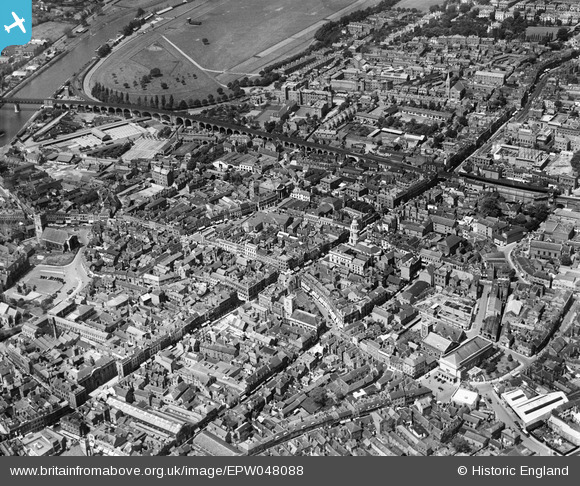
EPW048088 ENGLAND (1935). High Street, the Butts Siding and environs, Worcester, 1935
© Hawlfraint cyfranwyr OpenStreetMap a thrwyddedwyd gan yr OpenStreetMap Foundation. 2026. Trwyddedir y gartograffeg fel CC BY-SA.
Delweddau cyfagos (13)
EPW048088

EPW001298

EAW003989

EPW000211

EPW001302

EPW000399

EPW005407

EPW000204

EPW005406

EPW000206

EPW005384

EAW046113

EPW001300

Manylion
| Pennawd | [EPW048088] High Street, the Butts Siding and environs, Worcester, 1935 |
| Cyfeirnod | EPW048088 |
| Dyddiad | June-1935 |
| Dolen | |
| Enw lle | WORCESTER |
| Plwyf | |
| Ardal | |
| Gwlad | ENGLAND |
| Dwyreiniad / Gogleddiad | 384915, 255035 |
| Hydred / Lledred | -2.2207074531428, 52.19294441954 |
| Cyfeirnod Grid Cenedlaethol | SO849550 |
Pinnau

Class31 |
Saturday 21st of May 2016 10:26:45 PM | |

Red Baron |
Thursday 6th of June 2013 07:42:13 PM | |
|
Red Baron |
Thursday 6th of June 2013 07:41:13 PM | |
|
Red Baron |
Thursday 6th of June 2013 07:40:50 PM | |
|
Red Baron |
Thursday 6th of June 2013 07:39:19 PM | |
|
Red Baron |
Thursday 6th of June 2013 07:37:20 PM |
