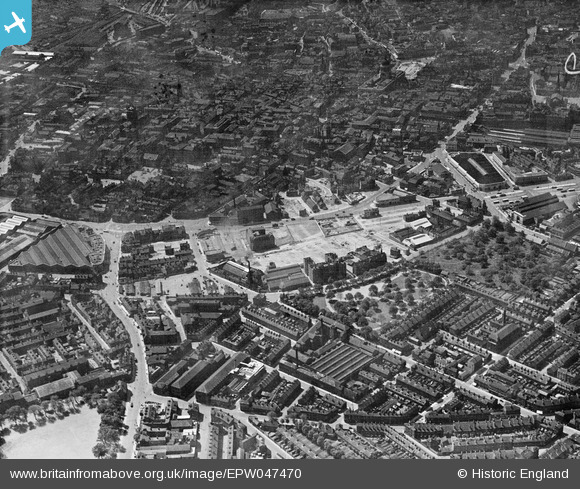
EPW047470 ENGLAND (1935). Victoria Park, Bath Street, Brook Street and the city, Nottingham, from the north-east, 1935
© Hawlfraint cyfranwyr OpenStreetMap a thrwyddedwyd gan yr OpenStreetMap Foundation. 2026. Trwyddedir y gartograffeg fel CC BY-SA.
Delweddau cyfagos (7)
Manylion
| Pennawd | [EPW047470] Victoria Park, Bath Street, Brook Street and the city, Nottingham, from the north-east, 1935 |
| Cyfeirnod | EPW047470 |
| Dyddiad | May-1935 |
| Dolen | |
| Enw lle | NOTTINGHAM |
| Plwyf | |
| Ardal | |
| Gwlad | ENGLAND |
| Dwyreiniad / Gogleddiad | 458022, 340145 |
| Hydred / Lledred | -1.136225377837, 52.955224610323 |
| Cyfeirnod Grid Cenedlaethol | SK580401 |


![[EPW047470] Victoria Park, Bath Street, Brook Street and the city, Nottingham, from the north-east, 1935](http://britainfromabove.org.uk/sites/all/libraries/aerofilms-images/public/100x100/EPW/047/EPW047470.jpg)
![[EPW008481] Handel Street and environs, Nottingham, 1923](http://britainfromabove.org.uk/sites/all/libraries/aerofilms-images/public/100x100/EPW/008/EPW008481.jpg)
![[EPW008485] Victoria Park and Alfred Street South and environs, Nottingham, 1923](http://britainfromabove.org.uk/sites/all/libraries/aerofilms-images/public/100x100/EPW/008/EPW008485.jpg)
![[EPW008585] Handel Street, Carlton Road and environs, Nottingham, 1923. This image has been produced from a copy-negative.](http://britainfromabove.org.uk/sites/all/libraries/aerofilms-images/public/100x100/EPW/008/EPW008585.jpg)
![[EPW050653] The Council House, Goose Gate and the city centre, Nottingham, 1936. This image has been produced from a damaged negative.](http://britainfromabove.org.uk/sites/all/libraries/aerofilms-images/public/100x100/EPW/050/EPW050653.jpg)
![[EPW055000] Brook Street and environs, Nottingham, 1937](http://britainfromabove.org.uk/sites/all/libraries/aerofilms-images/public/100x100/EPW/055/EPW055000.jpg)
![[EPW055023] Nottingham Bus Depot on Lower Parliament Street and environs, Nottingham, 1937](http://britainfromabove.org.uk/sites/all/libraries/aerofilms-images/public/100x100/EPW/055/EPW055023.jpg)
