
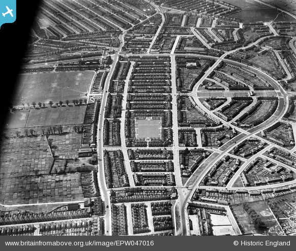
EPW047016 ENGLAND (1935). The White Hart Lane Estate, Tower Gardens, 1935
© Hawlfraint cyfranwyr OpenStreetMap a thrwyddedwyd gan yr OpenStreetMap Foundation. 2026. Trwyddedir y gartograffeg fel CC BY-SA.
Delweddau cyfagos (12)
EPW047016

EPW047011

EPW047015

EPW047020

EPW047014

EPW047010

EPW047017

EPW047018

EPW047013

EPW047012

EPW047019

EPW047009

Manylion
| Pennawd | [EPW047016] The White Hart Lane Estate, Tower Gardens, 1935 |
| Cyfeirnod | EPW047016 |
| Dyddiad | May-1935 |
| Dolen | |
| Enw lle | TOWER GARDENS |
| Plwyf | |
| Ardal | |
| Gwlad | ENGLAND |
| Dwyreiniad / Gogleddiad | 532724, 190648 |
| Hydred / Lledred | -0.083500723312352, 51.598544678964 |
| Cyfeirnod Grid Cenedlaethol | TQ327906 |
Pinnau

Class31 |
Sunday 30th of November 2014 03:15:39 PM | |
|
Class31 |
Sunday 30th of November 2014 03:08:42 PM | |

mardell8 |
Thursday 24th of October 2013 08:37:00 PM | |
|
bugbear |
Monday 30th of September 2013 12:49:33 PM | |
|
bugbear |
Wednesday 21st of August 2013 12:12:20 PM |

