
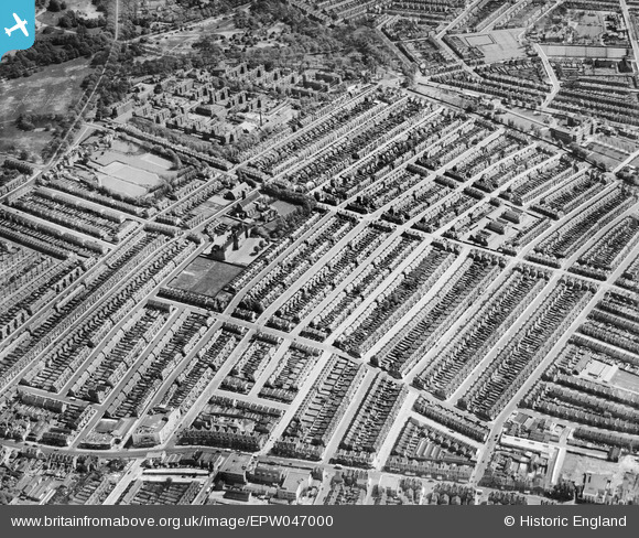
EPW047000 ENGLAND (1935). The Totterdown Fields Estate, Upper Tooting, 1935
© Hawlfraint cyfranwyr OpenStreetMap a thrwyddedwyd gan yr OpenStreetMap Foundation. 2026. Trwyddedir y gartograffeg fel CC BY-SA.
Delweddau cyfagos (9)
EPW047000

EPW046998

EPW047003

EPW047005

EPW047006

EPW047001

EPW046999

EPW046997

EPW047007

Manylion
| Pennawd | [EPW047000] The Totterdown Fields Estate, Upper Tooting, 1935 |
| Cyfeirnod | EPW047000 |
| Dyddiad | May-1935 |
| Dolen | |
| Enw lle | UPPER TOOTING |
| Plwyf | |
| Ardal | |
| Gwlad | ENGLAND |
| Dwyreiniad / Gogleddiad | 528035, 171717 |
| Hydred / Lledred | -0.15804760312831, 51.429481923086 |
| Cyfeirnod Grid Cenedlaethol | TQ280717 |
Pinnau
Byddwch y cyntaf i ychwanegu sylw at y ddelwedd hon!