
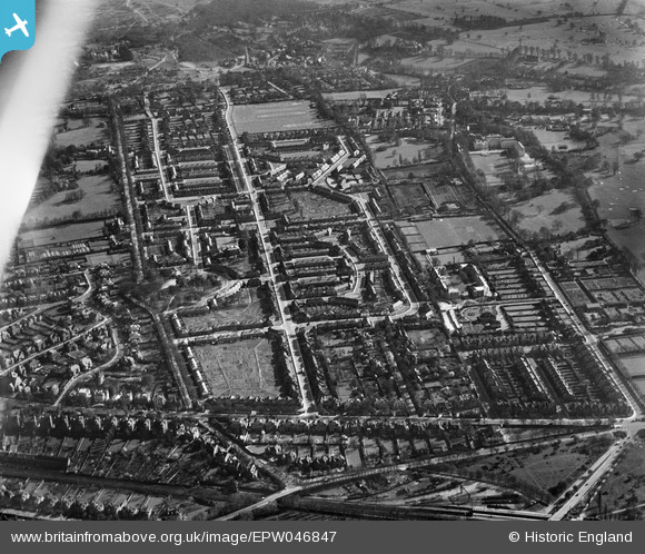
EPW046847 ENGLAND (1935). The residential area surrounding Huntingfield Road and The Pleasance, Roehampton, 1935. This image has been affected by flare.
© Hawlfraint cyfranwyr OpenStreetMap a thrwyddedwyd gan yr OpenStreetMap Foundation. 2026. Trwyddedir y gartograffeg fel CC BY-SA.
Delweddau cyfagos (5)
EPW046847

EPW046842

EPW046848

EPW046843

EPW046841

Manylion
| Pennawd | [EPW046847] The residential area surrounding Huntingfield Road and The Pleasance, Roehampton, 1935. This image has been affected by flare. |
| Cyfeirnod | EPW046847 |
| Dyddiad | April-1935 |
| Dolen | |
| Enw lle | ROEHAMPTON |
| Plwyf | |
| Ardal | |
| Gwlad | ENGLAND |
| Dwyreiniad / Gogleddiad | 522426, 175010 |
| Hydred / Lledred | -0.23755915273683, 51.460320348307 |
| Cyfeirnod Grid Cenedlaethol | TQ224750 |
Pinnau

Pink Sparkle Girl |
Tuesday 22nd of April 2025 08:58:15 PM |