
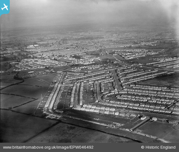
EPW046492 ENGLAND (1935). Residential development around Torbay Road and Newquay Crescent, Rayners Lane, from the south-west, 1935
© Hawlfraint cyfranwyr OpenStreetMap a thrwyddedwyd gan yr OpenStreetMap Foundation. 2026. Trwyddedir y gartograffeg fel CC BY-SA.
Delweddau cyfagos (4)
EPW046492

EPW040809

EPR000201

EPW040810

Manylion
| Pennawd | [EPW046492] Residential development around Torbay Road and Newquay Crescent, Rayners Lane, from the south-west, 1935 |
| Cyfeirnod | EPW046492 |
| Dyddiad | January-1935 |
| Dolen | |
| Enw lle | RAYNERS LANE |
| Plwyf | |
| Ardal | |
| Gwlad | ENGLAND |
| Dwyreiniad / Gogleddiad | 512409, 186878 |
| Hydred / Lledred | -0.37791318909328, 51.569078827105 |
| Cyfeirnod Grid Cenedlaethol | TQ124869 |
Pinnau

Keith |
Wednesday 24th of July 2013 03:17:10 PM |