
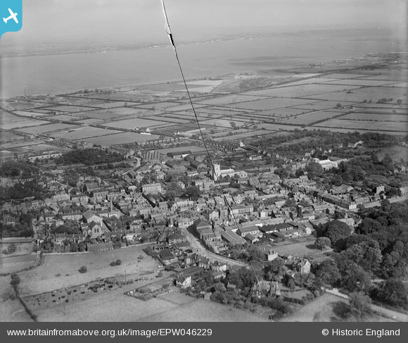
EPW046229 ENGLAND (1934). The town and the River Humber, Barton-upon-Humber, from the south-west, 1934. This image has been produced from a damaged negative.
© Hawlfraint cyfranwyr OpenStreetMap a thrwyddedwyd gan yr OpenStreetMap Foundation. 2026. Trwyddedir y gartograffeg fel CC BY-SA.
Delweddau cyfagos (21)
EPW046229

EAW046049

EAW046050

EPW046232

EPW046225

EAW046055

EPW046226

EPW046222

EPW046227

EAW046052

EAW046054

EAW046053

EAW046159

EPW046234

EPW046230

EPW046228

EPW012679

EAW046160

EAW046051

EPW046231

EPW012678

Manylion
| Pennawd | [EPW046229] The town and the River Humber, Barton-upon-Humber, from the south-west, 1934. This image has been produced from a damaged negative. |
| Cyfeirnod | EPW046229 |
| Dyddiad | September-1934 |
| Dolen | |
| Enw lle | BARTON-UPON-HUMBER |
| Plwyf | BARTON-UPON-HUMBER |
| Ardal | |
| Gwlad | ENGLAND |
| Dwyreiniad / Gogleddiad | 503107, 421813 |
| Hydred / Lledred | -0.43868899500943, 53.682359715203 |
| Cyfeirnod Grid Cenedlaethol | TA031218 |
Pinnau
Byddwch y cyntaf i ychwanegu sylw at y ddelwedd hon!