
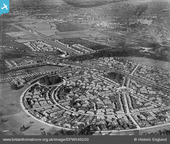
EPW046100 ENGLAND (1934). Housing estate at Sutton Passeys Crescent at the eastern edge of Wollaton Park, Wollaton, from the south-west, 1934
© Hawlfraint cyfranwyr OpenStreetMap a thrwyddedwyd gan yr OpenStreetMap Foundation. 2026. Trwyddedir y gartograffeg fel CC BY-SA.
Delweddau cyfagos (2)
EPW046100

EPW020936

Manylion
| Pennawd | [EPW046100] Housing estate at Sutton Passeys Crescent at the eastern edge of Wollaton Park, Wollaton, from the south-west, 1934 |
| Cyfeirnod | EPW046100 |
| Dyddiad | September-1934 |
| Dolen | |
| Enw lle | WOLLATON |
| Plwyf | |
| Ardal | |
| Gwlad | ENGLAND |
| Dwyreiniad / Gogleddiad | 454183, 339501 |
| Hydred / Lledred | -1.1934779493232, 52.949836987779 |
| Cyfeirnod Grid Cenedlaethol | SK542395 |
Pinnau

martynrb |
Monday 19th of December 2016 07:18:49 AM | |
|
johnxclarke |
Monday 31st of October 2016 03:24:25 PM | |
|
johnxclarke |
Monday 31st of October 2016 03:23:35 PM | |
|
johnxclarke |
Monday 31st of October 2016 03:23:10 PM | |
|
johnxclarke |
Monday 31st of October 2016 03:22:37 PM | |
|
johnxclarke |
Monday 31st of October 2016 03:21:56 PM | |
|
poohdog |
Tuesday 8th of July 2014 10:24:05 PM | |
|
poohdog |
Tuesday 8th of July 2014 10:20:12 PM | |
|
JasAloysius |
Saturday 7th of June 2014 10:20:55 PM |