
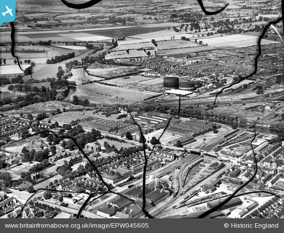
EPW045605 ENGLAND (1934). The Britannia Iron Works and environs, Bedford, from the east, 1934. This image has been produced from a damaged negative.
© Hawlfraint cyfranwyr OpenStreetMap a thrwyddedwyd gan yr OpenStreetMap Foundation. 2026. Trwyddedir y gartograffeg fel CC BY-SA.
Delweddau cyfagos (17)
EPW045605

EAW032057

EAW032053

EAW032056

EAW032060

EAW032054

EAW032062

EAW032051

EAW032063

EPW045530

EPW026475

EPW045525

EAW032059

EPW046443

EAW032058

EPW045529

EPW022392

Manylion
| Pennawd | [EPW045605] The Britannia Iron Works and environs, Bedford, from the east, 1934. This image has been produced from a damaged negative. |
| Cyfeirnod | EPW045605 |
| Dyddiad | July-1934 |
| Dolen | |
| Enw lle | BEDFORD |
| Plwyf | |
| Ardal | |
| Gwlad | ENGLAND |
| Dwyreiniad / Gogleddiad | 504700, 249050 |
| Hydred / Lledred | -0.47027841905163, 52.129415157533 |
| Cyfeirnod Grid Cenedlaethol | TL047491 |
Pinnau
Byddwch y cyntaf i ychwanegu sylw at y ddelwedd hon!