
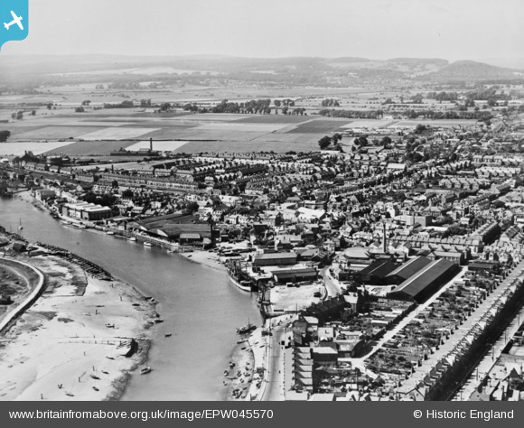
EPW045570 ENGLAND (1934). Wharfeage alongside the River Arun and environs, Littlehampton, from the south, 1934. This image has been produced from a copy-negative.
© Hawlfraint cyfranwyr OpenStreetMap a thrwyddedwyd gan yr OpenStreetMap Foundation. 2026. Trwyddedir y gartograffeg fel CC BY-SA.
Delweddau cyfagos (10)
EPW045570

EAW012227

EAW012228

EAW012239

EAW012238

EAW022238

EAW022241
, the seafront and the town, Littlehampton, 1949")
EPW039465

EAW012231

EPW011536

Manylion
| Pennawd | [EPW045570] Wharfeage alongside the River Arun and environs, Littlehampton, from the south, 1934. This image has been produced from a copy-negative. |
| Cyfeirnod | EPW045570 |
| Dyddiad | July-1934 |
| Dolen | |
| Enw lle | LITTLEHAMPTON |
| Plwyf | LITTLEHAMPTON |
| Ardal | |
| Gwlad | ENGLAND |
| Dwyreiniad / Gogleddiad | 502667, 101862 |
| Hydred / Lledred | -0.54275011419747, 50.806641246173 |
| Cyfeirnod Grid Cenedlaethol | TQ027019 |
Pinnau
Byddwch y cyntaf i ychwanegu sylw at y ddelwedd hon!